Browsed by
Tag: mnstateparks

international, even!

international, even!

after last year’s star photos up the north shore, i wanted to have another go at them, so i consulted my weather calendar early this year and found a weekend that would work for moonrise/moonset and made a reservation. labor day weekend was that weekend!

jane and i met at jay cooke state park on friday night for an overnight before heading up the shore.

there’s a reason this park is my #3 park! it may have been promoted to #2! (don’t worry blue mounds – i’ll visit you again before making that decision.)

i have to say my new tent is pretty awesome. it’s not as spacious as my old tent, but dang it stays dark! you almost need a flashlight to see what’s going on in there during the daytime.

anyway, we checked out the bridge and the falls at jay cooke before the sun went down at too-early o’clock in the evening. then we bundled up for bed because it was cold that night! i wore a wool shirt, a sweatshirt, and my down vest to bed, along with a winter hat and a blanket inside my sleeping bag. i was toasty.

the next morning we packed up and were on the road before 9 a.m. to head up the north shore. we stopped at the rustic inn just north of two harbors for breakfast pie, then headed up to check out grand marais.

i’ll tell you one thing: i forget how big this lake is. and the part you see from MN is not the big part of the lake. holy shamoly. grand marais was cute with its touristy shops and the marina. i wouldn’t mind spending a couple overnights in grand marais sometime.

then it was time for #moosewatch2019 as we headed up the gunflint trail into the BWCA. there was actually a moose outlook/observation deck along the way, so we hiked the half a mile or so to see if we could see some moose. my minimal moose investigation tells me that they like to hang out in swamps in the early morning, so the chances of seeing a moose at 1 p.m. were slim, but i wanted to at least try. once again, #moosewatch was a fail.

(then today i’m browsing twitter and i see a post about how a stray moose was just lollygagging across the football field at UND. seriously? good grief.)

but we drove up to gunflint lake, which is a border lake and along a nice little drive. then we headed back down to get to our campsite before dark.

the next two nights we spend at judge magney state park, where lori and i stayed last year. there is a nice little beach not even a mile down the road that’s great for star viewing, and the park itself is really small and non-electric, so there are no big campers and 5th wheelers. it’s nice to be in a quieter park, even if your neighbor doesn’t know how to use her inside voice after quiet hours have begun and the other neighbors brought two dogs who bark at anything that moves. -_-

we managed a decent fire and were hoping for clear skies, but ALAS it clouded over, so no star and no northern lights, which i guess were pretty awesome this past weekend. come on, weather. that part was disappointing.

let me digress here a moment and talk about camping coffee. there’s something about cooking coffee over a campstove and then sitting outside in the cold morning to drink it. it was invigorating! i have a percolator pot that kind of sucks, so i bought a stainless steel french press to make the coffee in. i use the pot to boil the water. it works out great.

ok, back to what was going on. after the star disappointment, the next morning we made some tasty scrambled eggs, then headed up to see devil’s kettle falls, which is what the park is known for. the hike up is only a mile, but man it’s a heck of a mile. hills, rocks, roots, 150+ stairs. but it was worth it!

so weird! one half of the water just dumps into a big hole in the ground.

i think the more picturesque scene was the river just before the falls.

it was a nice morning – still a little crisp, the sun wasn’t overbearing, and the crowds weren’t bad yet. we walked maybe another quarter mile up the lake superior trail, then headed back (and walked up the 150+ stairs. ooofda).

then we decided to make it international!

but first we stopped at grand portage national monument and learned about the fur trade, which i want to read more about. i guess the canadian version of lewis and clark is a lot more rugged and daring and made his way through more miles. that part of the state is still the best part of the state, i think. it’s mountainish, trees abundant, giant lake. <3

and i saw the closest thing to moosewatch i was going to get this trip.

🙁

then it was time to go to canada!

the drive up to thunder bay was amazeballs. it reminded me of a more woodsy colorado. it was great! pines and aspen all over the place, then these butte-esque mountainish hills. there’d be a field of wildflowers or grains that were yellow against the grey/blue sky then a butte would pop up as a backdrop covered in trees. ahhh, it was great! i’d definitely go back.

the bay at thunder bay was super interesting, with those butte-esque hills popping up as islands out of the lake.

then we headed back to the US, where the customs guy was not as fun as the canadian customs guy. he didn’t care if we brought live bait or ammunition back into the country. i wonder if he would’ve cared if we’d stopped at marijuana palace. (yes, that was a place we saw in thunder bay.)

on the way back to the park, we stopped at the casino in hopes of a big win, but it wasn’t to be. instead, i lost my firewood money and we had to stop at the gas station to pick some up, which was also a big loss. it was wet! i even bought two bundles, but it didn’t catch.

what a bust! and the clouds were even worse that night, so once again no stars. i’ll have to go back for some more astrophotography (oh no how sad).

and that was that. the next morning, we packed up and were on the road before 9 a.m. we stopped at betty’s pies on the way back and decided to visit the rustic inn from now on because the line at betty’s was stupid long and also the pie i had there was better.

i could go for some pie right now.

dropped jane off at her car at black bear casino (we did NOT go in), then headed down a busy I-35 and not-as-busy-as-i’d-expected hwy23*. and now it’s back to the grind!

i might make this a yearly thing!

*so i ended up driving to jay cooke on hwy23 the whole way, and now i have driven on every foot of hwy 23. i don’t know if that’s an accomplishment or not, but i thought it was interesting.

here we go again!

here we go again!

today i posted a comment on liz’s blog that it’s been a year since she posted anything. “dead blog”. i’m one to talk, huh? i don’t blog as much as i used to, and i wonder if it’s because i’m blogged out, or if anything current i’d want to talk about is out of the news cycle so quickly and replaced by another, more insane item of note, that i get distracted and can’t even think anymore. (by the way – i don’t know about you, but i’d consider move to greenland if it became a state. *eyeroll*)

i’ve been listening to a fascinated podcast lately about a current SCOTUS case involving oklahoma and american indian reservations – how if they are still recognized, half the state would be, in fact, indian country. it’s called “this land” if you want to give it a try. i haven’t finished it yet, but i’m hoping to get around to listening to the rest in the next week.

i miss visiting state parks. last year after the derry reunion, i traveled up to lake of the woods and then over to the northwest corner, down to bemidji, itasca, and over to moorhead to catch some parks that way. i put on 1000+ miles that loop. then my cousin lori sent me a text message a couple weeks ago with a pic from a year ago up the north shore.

early august i was down in mankato taking family pictures for a friend, and on my way back i drove past one of the parks that was one of the last two i visited last year. on a complete whim (as in, i saw the sign and put on my blinker), i drove in and took a meander through. last year when i was there, it was early october and the leaves were brown (fall was not good last year). this year the fishing pier that i strolled out onto to take a couple pics was in the midst of vibrant green cattails and a shimmering lake, and the part of the park that was close to the lake was soggy due to the rain and probably spring flooding.

i spent more time at the park than i did last year just going on a little walk on a trail and taking pics of random things. then i drove out to the park entrance, stopped at the ranger station, and picked up another passport book. 🙂

i’m not planning on being as aggressive as last year on it. i told the ranger what i did last summer and she said “WHAT??” so not everyone is as driven (persistent, as jan derry would say) as i am on these things. so i’ll take this one a little slower! maybe try to get them all in three years instead! or 5. or just see what happens. any excuse to get out and see a little more of the state than most people do.

speaking of that, jane and i are heading up to the north shore over labor day weekend. we’re even going to make it international and head up into canada. it’ll be nice to get back up there, and i planned it so i can get some more astrophotography in. i’m hoping for some clear skies!

itasca: revisted

itasca: revisted

i think i need to amend my top ten state parks list and make itasca 1 AND 2. i just spent five days there with my family and want to rave about this park even more.

i think it says a lot that the time i spent at the headwaters was minimal and didn’t make much of an impression on me. what made an impression? the trees, the bike paths, the hiking path, the big trees.

oh, and the BEAR i saw.

my sibs and i were biking to the swimming beach, when some bikers whooshed past us telling us there was a bear with cubs ahead. well, jane wanted to turn around, but dang if i wasn’t going to at least see a bear, amirite? so we slowly biked until we saw the bear, then turned around.

we also took the wilderness drive and saw the state’s largest white pine and state’s former largest red pine (it was the victim of a wind storm. the largest is now in the lost forty).

the tree was so big that my mom held onto her head with amazement. that same day we also checked out preacher’s grove where a bunch of old-growth red pines are, along with a bunch of pines that had blown over in some sort of wind storm that twisted them.

(my mom and aunt rae discussing weather patterns that may have caused the twisting.)

i tried out supping, but forgot my fin so it was no fun. then i went for a hike along the brower trail, which is GREAT. this was the sort of trail i was looking for in the black hills but couldn’t find.

some yellow ladyslippers just bloomed while i was out on the trail.

and other flora!

the bike trail was also great for running if you want to do hillwork (i did need to work on that, i guess. i prefer flat, but i couldn’t resist running in itasca). i went out for a 6-mile run on sunday night.

we stayed at bearpaw cabins/campground, which was between the headwaters and the lodge, so it was a nice, bikeable distance to both. we ate supper at the lodge a couple times, had breakfast there once, and had ice cream a couple times at the headwaters cafe.

i could’ve stayed another couple days at itasca and hiked some of the spurs and trails that were on the wilderness drive, biked some more, looked for more bears, put the fin on my SUP and really done some good paddling, gone for another hilly run.

still enamored by itasca!

stargazing

stargazing

it was in the deep heart of a smoggy august when my cousin lori and i headed up the north shore and back to central minnesota to hit up 18 state parks over a 3-day weekend. wildfires in canada brought smoke across the sky, turning it from the deep azure of late summertime to a pale white with an anemic sun that tried to burn its way through the cover.

we had spent the previous day stopping at mille lacs kathio, banning, and jay cooke state parks. we were ready for the shore part of the trip.

the smog made for surreal looking landscapes along the lake; while we meandered our way up the shore, it was hard to discern where the lake ended and the sky began, and the craggy rock outcrops stood out in sharp relief.

of course we made all the stops: a mid-morning snack at betty’s pies (me the blackberry peach; lori the maple walnut), a stop at gooseberry before the crowded madness of mid-afternoon, and the ensuing parks along the highway as we headed northeast.

of all the itineraries during my summer of state parks, this was by far the easiest trip but also the most park intensive. the only park that was out of the way was george crosby manitou, and that was just a short jaunt off hwy 61. the rest of the parks along the north shore were just a pull-off hwy 61 into a parking lot, and that made for an easy trip. as we headed more northerly, the parks grew less crowded, the shore more gentle, and the drive a little easier.

prior to this, i hadn’t been past grand marais, and even then it had been 20 years since i’d been that far up the shore. while the smog persisted, lori and i persisted up the coast, and it turned out to be one of the more breathtaking drives i’d take during the summer visiting the entirety of the state. the cragginess was gone, replaced by easy slopes and tall hills filled with pines. the closer we got to the border, the more beautiful the landscape became. we stopped at grand portage national monument, and while we were too late to check out the visitors’ center, we stopped to take in the views of the bay. the smog had dissipated a little throughout the day, and standing at the edge of minnesota staring at the big lake into its canada and michigan parts, one could only try to imagine canoeing across the water for weeks and finally seeing this bay as a destination, a reprieve.

our stay that night was at judge cr magney  state park, the most northeasterly state park with a campground. i had done a lot of research before choosing a weekend to stay at this park, making sure we were visiting during a time when the moon was the least visible. the past few years i’d dabbled in astrophotography, and i was on a mission to see the milky way in as much glory as i could.

after reading the book “the end of dark” by native paul bogard, i had become more aware of how lighted we are in the more populated areas. i knew that my trips to the state parks might bring me opportunities for night sky viewing, and i had done my best to create the best conditions. while i plotted according to moonrises and new vs. full, i never foresaw the smog. another thing i hadn’t known about during my plans was the perseids showers, which were to peak that evening. i held out hope that the smog would be pretty minimal and the perseids pretty great.

on the way back to judge cr magney park, lori and i stopped at small beach on the side of the road which turned out to be an ideal spot for some star watching. the beach was comprised of small pebbles and swung around to the southeast, creating a small bay. the water was almost calm, and small waves lapped at the shore. it was still hard to separate the water from the sky at a distance, but if the sky remained clear, we’d be able to see some stars that night.

we set up camp. judge cr magney is a small campground with very few campers; the majority of visitors to the park that evening used tents or small pull-behind pop-ups. after our tent was up, lori and i went for a quick walk around the park, then decided it was too late in the day to check out devil’s kettle falls. instead, we picked up a bundle of firewood and had a fire while cooking supper on our campstove. i set up my hammock between two trees. we organized the camp box and made sure the wet towels we had thrown in the box that morning were set out to dry. after a day of driving and stopping, hiking and sightseeing, it was nice to do menial tasks with feet on the ground.

meanwhile, we had to wait for the sun to reach past astronomical twilight and into dark night, which is when the sun is 18º below the horizon. that was about 10:30 p.m. so while it appeared the sun was set, we needed to wait a bit longer. lori took a nap in the hammock. i sat in my camp chair by the fire’s embers and read a book by my headlamp. at 10:30, i whisper-shouted to lori across our site, and her head popped up from the hammock. time to go.

i was excited about seeing the stars in their full glory. lori was just along for the ride, and i have a feeling if she’d been a tiny bit more tired, she may have stayed in the tent. as it was, she dragged her sleeping bag along with her into the car. i made sure i had all my camera gear.

it’s an eery thing, starting your car in the middle of the night in the middle of a silent campground. it felt sacrilegious, especially when i turned on the headlights. i quickly turned them to parking lights until we were out of the campground loop.

not even a mile down the road, we pulled into the small beach parking lot. and as soon as i stepped out of the car, i could see it: the milky way.

most people need to let their eyes acclimate to see stars beyond the few bright ones in our skies near metro areas. it takes up to 3 hours before humans’ eyes are fully opened for night vision in full dark conditions. but we were far from any metro, or any a small town, so even with our closed pupils, the stars spread across the sky, pinpricks of white in dark.

a ball of fiery red lay low on the horizon; i don’t think i have ever seen mars so red or so clearly. i can only imagine what the night would have been like if it’d been completely smog free. if the water had been calm, we’d’ve seen the reflection on the water.

i with my camera equipment and lori with her sleeping bag, we set up camp on the pebbly shore. i did my best with my photos, moving around to get different shots of the stars, the milky way, and by chance, perseids shooting across the sky in long swipes. after 45 minutes of trying different settings and various positions (i am amateur at best), i set aside the camera and sat on the beach alongside lori and watched the stars and meteors burning up in the atmosphere.

close to midnight, i was spent from the long day along the shore, and i suggested we go back to camp before i fell asleep on the beach. at this point, i was unsure of how lori was faring with the amount of time we’d spent on the beach, and i felt a little guilty forcing her out for stargzaing. but it turns out that she was reluctant to return to camp and said she’d stay out there all night if she could. i turned back to the sky and we watched for a while longer.

when watching stars like this, at some point, you lose yourself in the sky. you get lost in the stars. you forget that you are solidly held to the ground with gravity, and part of you senses that, given release, you’d float into the galaxy – become one with the spots of light. the wide sky takes up your entire vision and the primal part of your brain says “hold on!” lest you become one with the stardust. but of course we are all stardust. we forget that we are one with the stars.

explore mn!

explore mn!

i started in april at lake maria in the middle of minnesota with snow on the ground and an ambitious summer planned. i finished up my visits to 72 minnesota state parks and recreation areas in october, stopping at rice lake on the way to the southern part of the state.

so many people get caught up in their pockets of home, work, favorite destinations. so many people talk about visiting other countries regularly, heading to a coast every spring break, living the winter months in the southwest US.

but you don’t hear a lot about people visiting different areas of minnesota, about how varied and interesting our own state is. i traveled across most of the counties during my summer travels, sat in the four biomes the state boasts (pretty good for a non-mountainous state), found the place where three watersheds diverge, and drove through the highest points in the state and the lowest. i watched fireflies blink from the prairie in june in the southwest and saw the milky way spread across my vision during a moonless, clear night in august in the northeast. from lake bronson to beaver creek; blue mounds to grand portage; wow does minnesota have a lot to offer.

minnesota has 76 state parks and recreation areas in all parts of the state, providing outdoor activities for all residents. and we do like our parks: every year, more and more minnesotans use the parks. unfortunately, the state congress has been underfunding the parks system. like education, the parks system used to get a large chunk of its money from the state’s general fund and the rest from fees, licenses, etc. now, only a fifth of its budget comes from the general fund. other funding at this point includes the legacy amendment, lottery money, licenses, and fees. at the same time, the parks want to increase its system. people want more groomed trails and acres in their parks and more people use them, but even still, funding is cut.

this means that fees continue to increase and the DNR reduces funding to more of the smaller parks, especially in rural minnesota. last winter, cross-country ski trails at 20 parks went ungroomed. while volunteers are readily welcomed, to do so means that liability insurance needs to be increased.

cuts will start to be made, with 34 parks on the chopping block (including grand portage, the the one at the very tip of the arrowhead AND the final destination in the most beautiful part of the state, in my opinion). this means trails go ungroomed, so much so that they may no longer be trails. campgrounds may be closed for part or all of the season. those 34 parks, of course, are rural parks in sparsely populated areas with fewer regular visitors.

these, of course, are the parks most vital to seeing the state and encouraging residents to get outside.

while i will happily pay more for camping and for my annual permit, not everyone can afford to or is able to do so. and i would encourage all mn legislators to step up and upkeep the parks system that we should be so proud of, one that is available to ALL minnesotans.

but what i really want to encourage is all minnesotans, especially those in the metro, to visit more of the lesser-known parks. head up to grand portage and judge cr magney – even stop at grand portage national monument and sit at the edge of north lake superior, where the hills are tall and tower above the low-level lake and the milky way is visible as soon as you look up at the night sky.

find the restored prairies and bison herd at blue mounds, where you’re so close to south dakota that the wind whispers across the tall grass, telling you to go west.

step onto the swinging bridge over beaver creek, where the water runs clear over polished stones with watercress green in the current.

follow the mississippi river from its source at itasca, the crown jewel of the state parks system, through lake bemidji, schoolcraft, savanna portage, crow wing, lindbergh, lake maria, fort snelling, frontenac, john latsch, great river bluffs.

learn about the rise and fall of late 19th-century towns as the railroad chose to bypass both crow wing and forestville.

step onto the white sand beaches of zippel bay, and listen to the waves of lake of the woods breaking on the shore at night a half mile away in the campground because it’s so quiet.

learn about this great state we live in; the parks are so much more than recreation. you learn about the history, wildlife, ecology, geology, and environment that make minnesota what it is.

there is so much to see in this state we call home, and the parks are the best way to learn what it has to offer. get out there and explore them.

mn state parks: top 10

mn state parks: top 10

here’s my definitive (sort of) list of the top 10 state parks in minnesota. after a summer of driving and traipsing around the state to visit 72 state parks and recreation areas, this list is the result of what parks i would visit again given the chance.

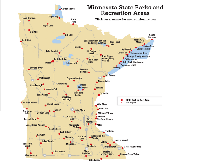
i knew that not all parks would be my cup of tea, and not all parks would be a destination. but here’s what i do know: there is a park in close proximity to every minnesotan. there’s no excuse to not visit a state park. however, if you want to make a park in minnesota a destination? here are the 10 parks i recommend.

EDIT: apparently i need to clarify some stuff. i enjoyed the north shore. i consider jay cooke to be a part of the north shore parks. but i guess it is not because the big lake is not visible. but here’s my thing: EVERYONE LIKES THE NORTH SHORE. everyone GOES to the north shore. the parks there are visited SO MUCH. they are not in danger of losing funding or support. so i include jay cooke as my favorite “north shore” park even though no big lake. and i include judge cr magney on my bonus national monument park. if i could place grand portage national monument on my state park list? it would probably be #3 or #4. But here’s the thing: you need to GET OUT AND LOOK AT THE REST OF THE STATE. it is FANTASTIC, this state. sure, the north shore is great, but so is itasca and hayes lake and whitewater and BLUE MOUNDS. GET OUT THERE!

1. itasca

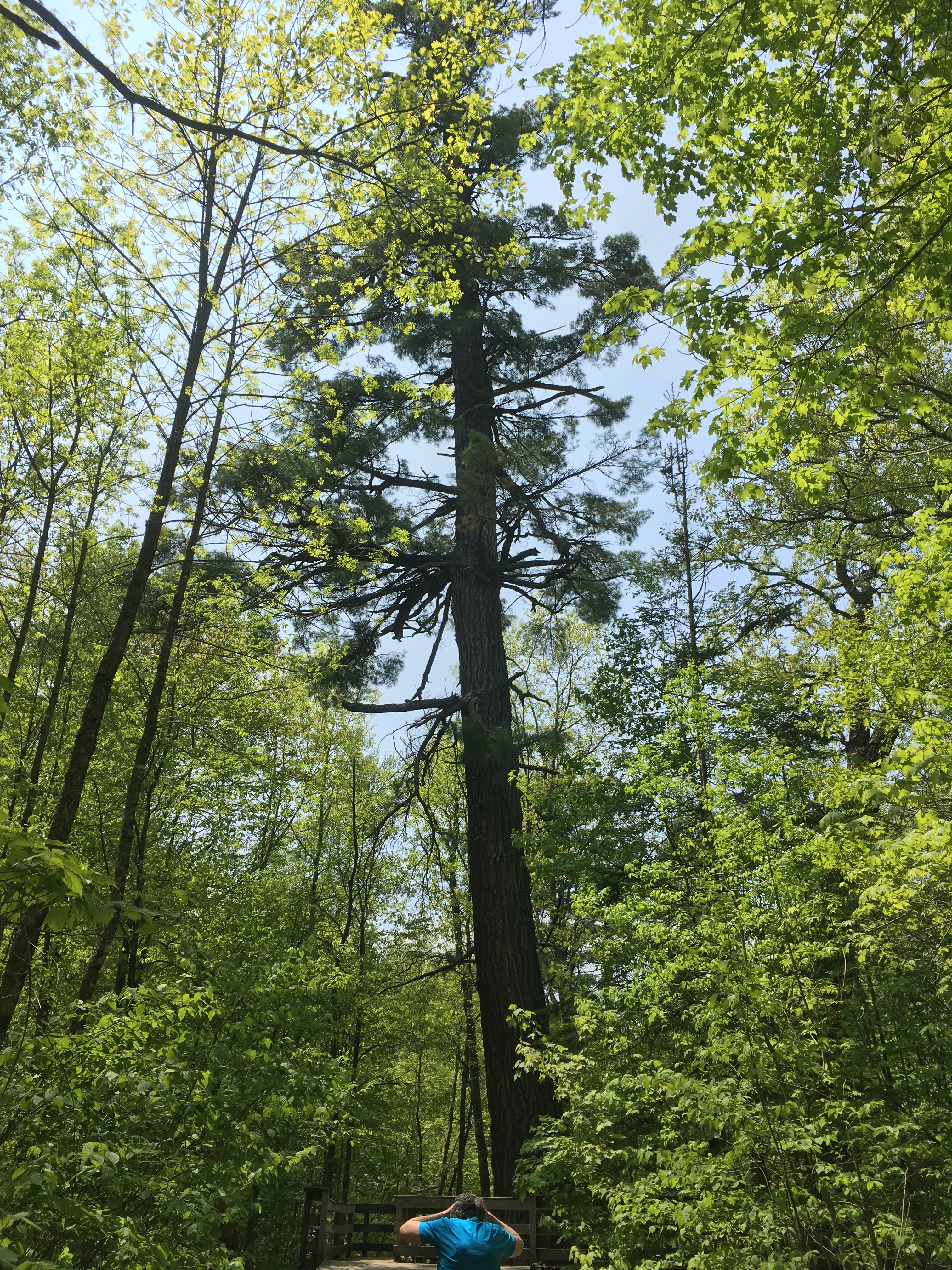
itasca was the first state park and is considered the crown jewel of the parks system. it’s the 3rd-most-visited park in the state (behind snelling and gooseberry) and is the 2nd largest (just closely following st. croix at 32,700 acres), located up by park rapids (it’s about 20 minutes from bemidji). it houses the headwaters of the mississippi and the biggest red pine in the state.

it’s also got two campgrounds, several cabins, a lodge, a restaurant, an interpretive center, ANOTHER interpretive center, two gift shops, the best CCC built structure, a wilderness drive, bike paths, hiking paths, several historical sites, and many lakes where you can spend some time.

two anecdotes: 1) i passed through from bemidji to home and only planned on spending 30-45 minutes at the park. i ended up spending 2 hours there. and this was a drizzly gross day in july; 2) right after visiting, a coworker of mine stopped by and asked me about itasca and if he should take his visiting parents there. i said absolutely, though he wasn’t convinced. after he got back, he came to my office and raved about the park. next time his parents visit, they want to spend a week there.

so NO JOKE when i say that itasca is the real deal. i convinced my entire family to spend 5 days there next june. that’s how much i am enamored by itasca.

it’s number one in my book. 😍

2. blue mounds

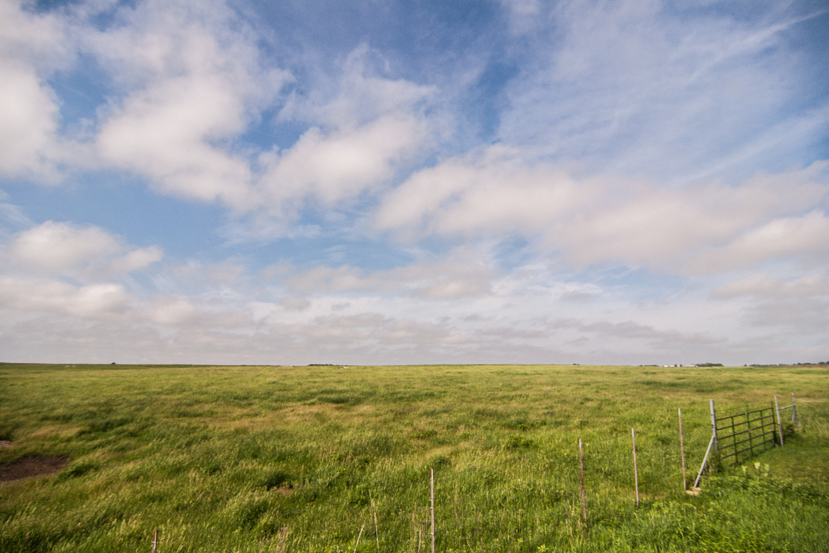
here’s why i like blue mounds state park, even though the average person will take a look at its location (far SW corner of the state) and wonder why this is worth the trip.

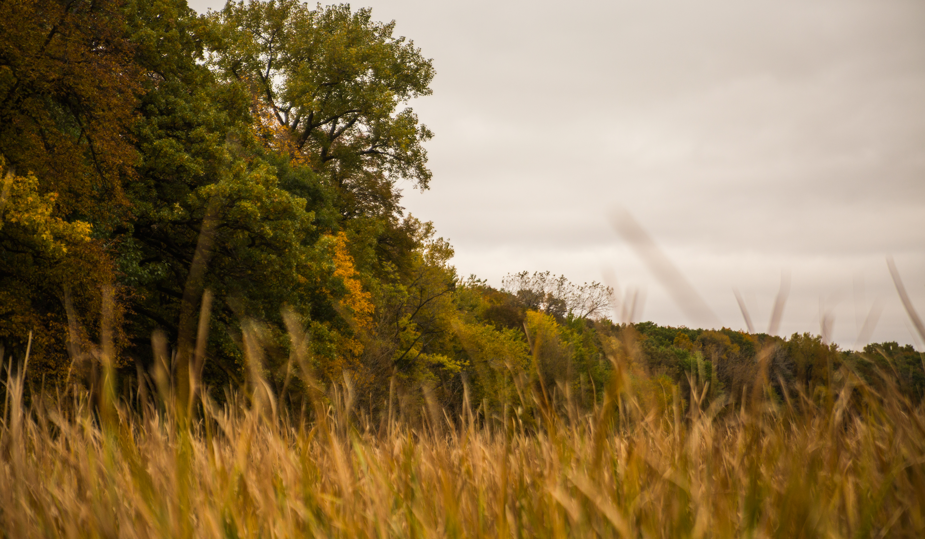
take a look at that picture: take in the wide blue sky, the waving grass, and imagine that a buffalo herd is wandering across the prairie. (blue mounds has a bison herd but they weren’t wandering close to the fence this day.) to me, blue mounds screams: GO WEST GO WEST GO WEST and i want to load up my car on an early june morning and set out across south dakota, across the prairie, to the hills, to the rough red buttes, to the mountains.

minnesota is in a great place of the country. while non-mountainous, it houses three (perhaps four) distinct biomes, highly unlikely for a non-mountainous state. it’s also home to three watersheds, also unlikely for non-mountainous states. so while a geological wonder, most people just see boring corn fields or monotonous tree-lined roads.

get out and visit blue mounds because it’s a great example of the diversity this state has to offer. the rangers are harboring a patch of dirt that grows native prairie grasses, which supports the bison herd that lives in the park. the location, buffalo ridge, also shows us the varied altitude within the prairie, giving way to lower areas on one end of the park to wide vistas.

go west without even leaving the state.

3. jay cooke

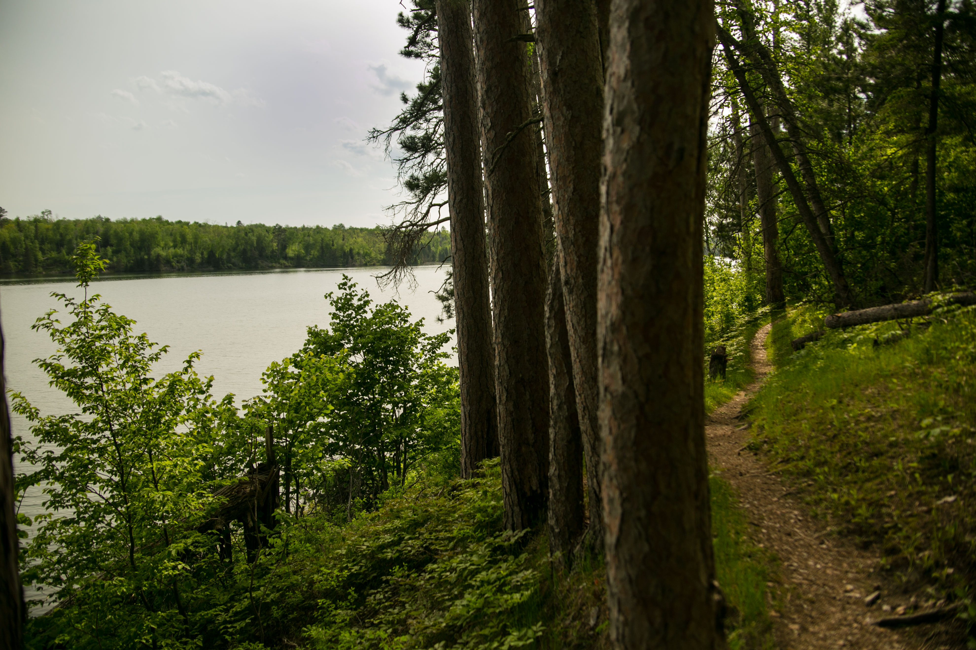
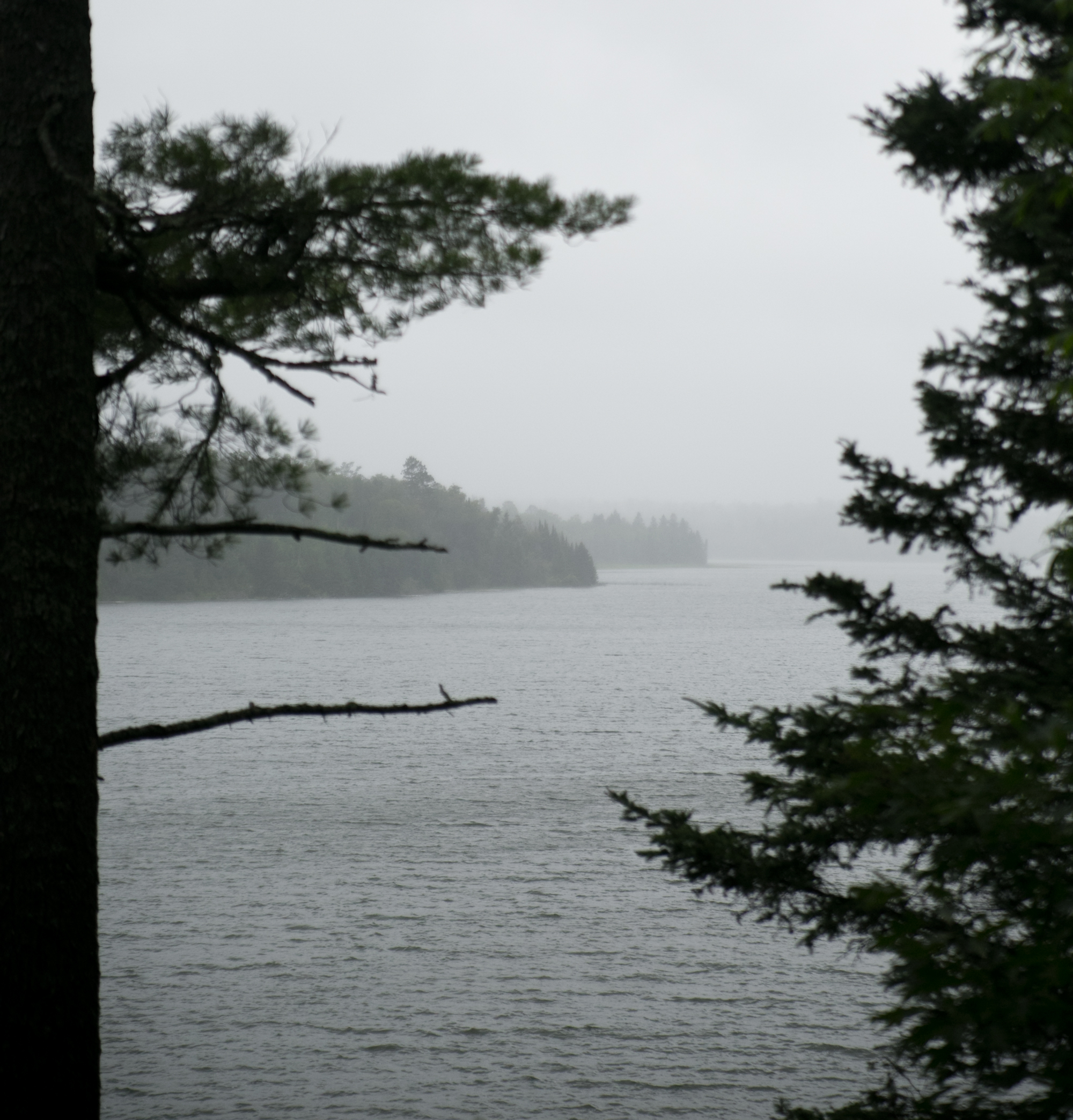
and in stark contrast the wide-open spaces of blue mounds, we hop to the northeastern-ish area of the state, with tall pines and slate rock.

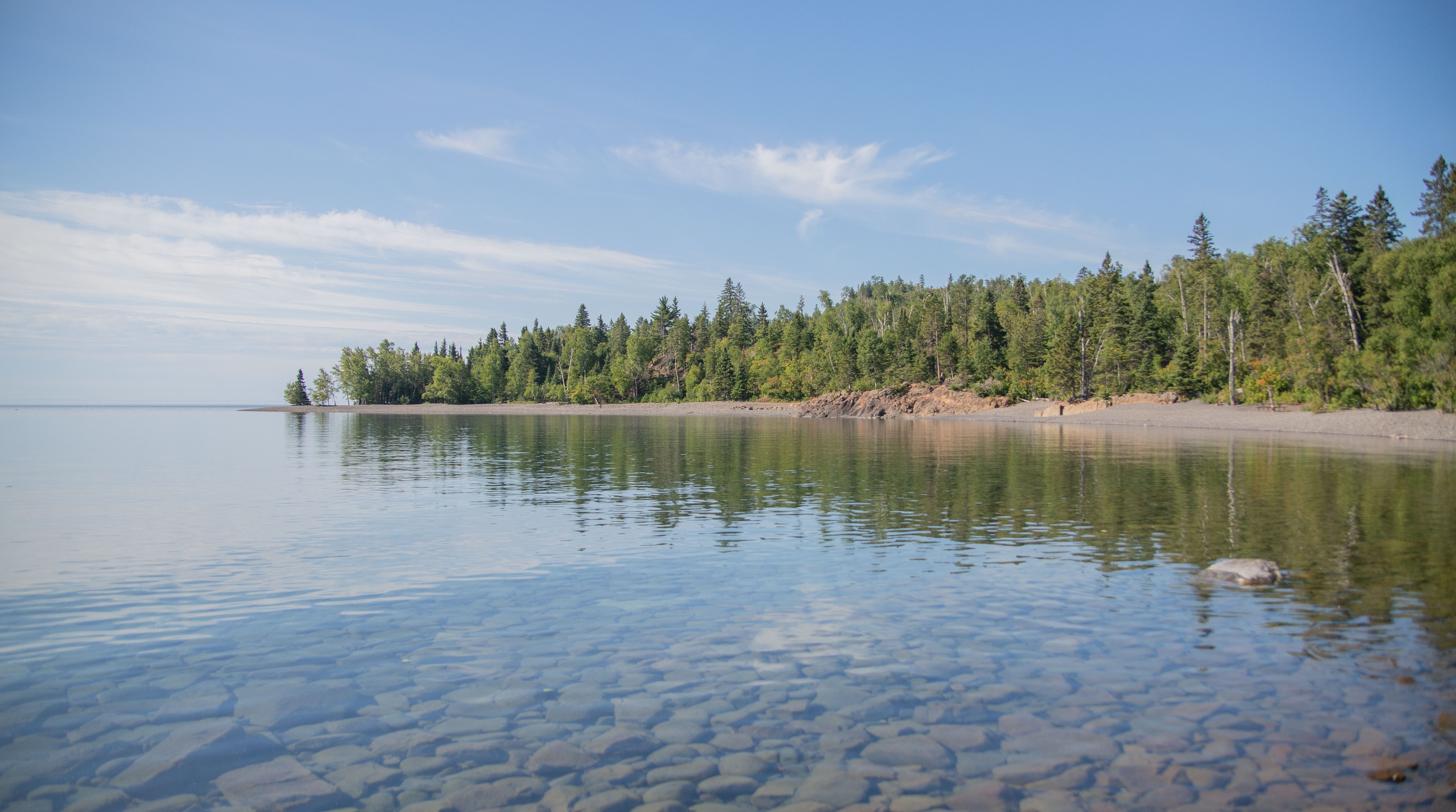
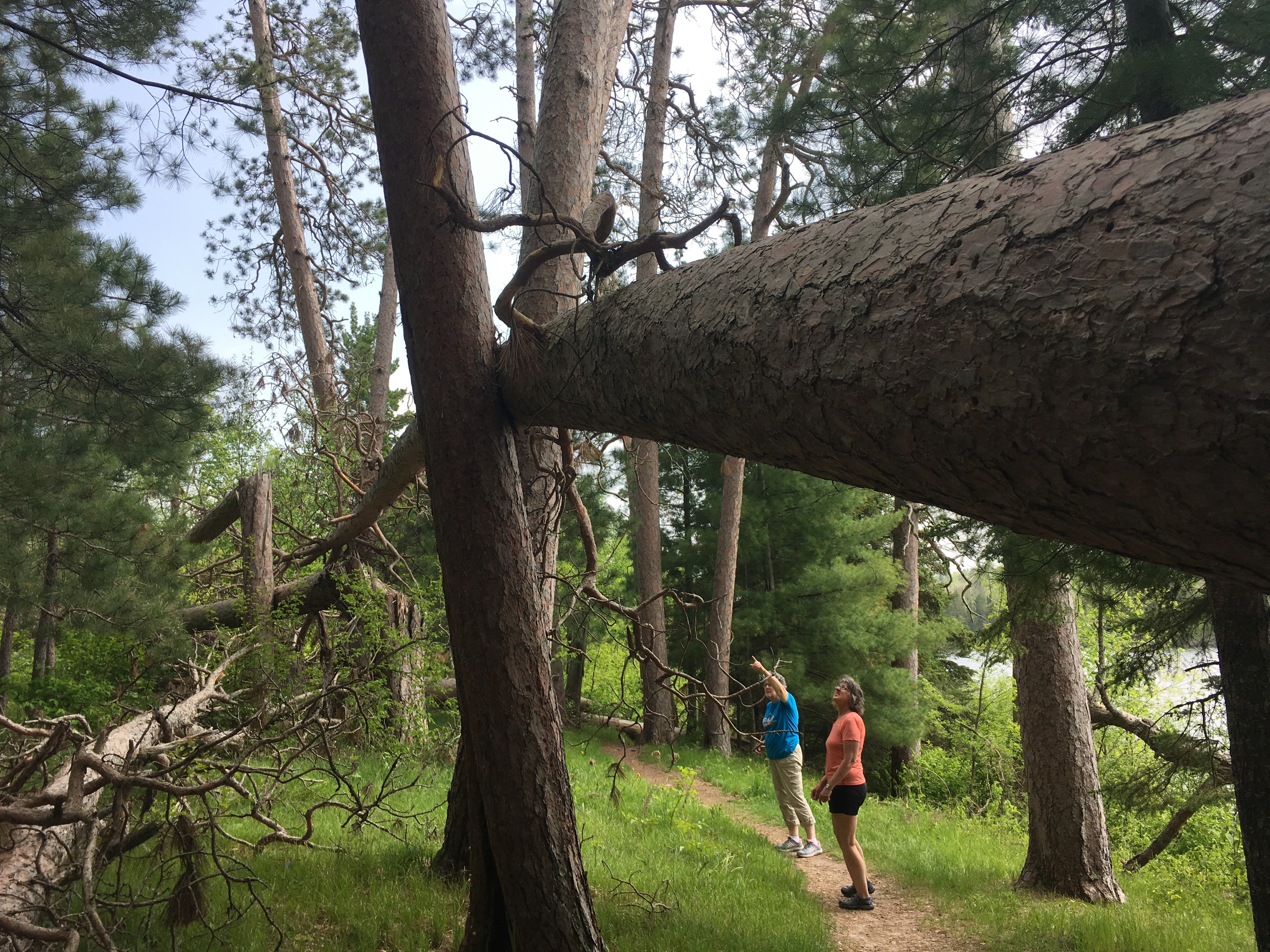
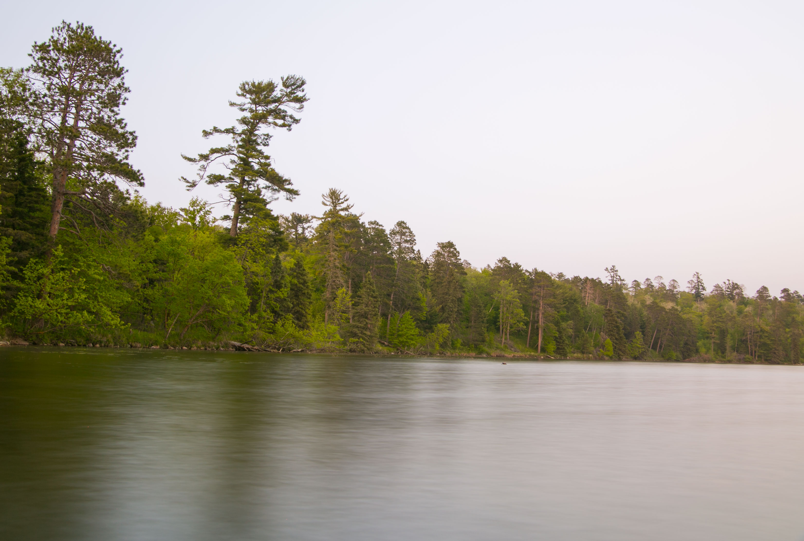
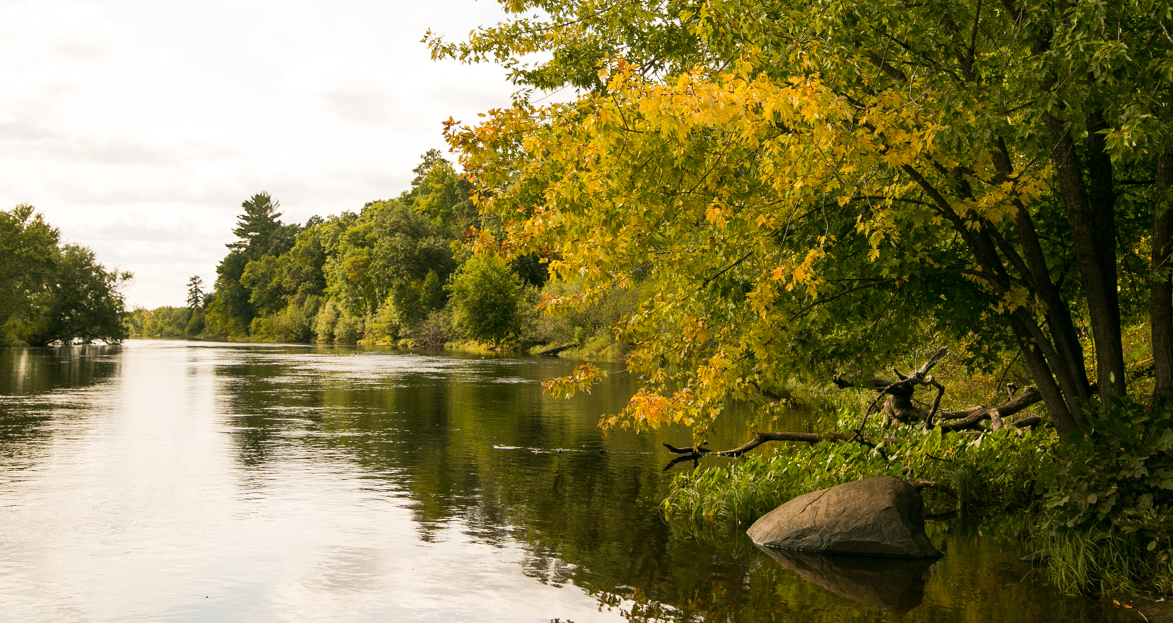
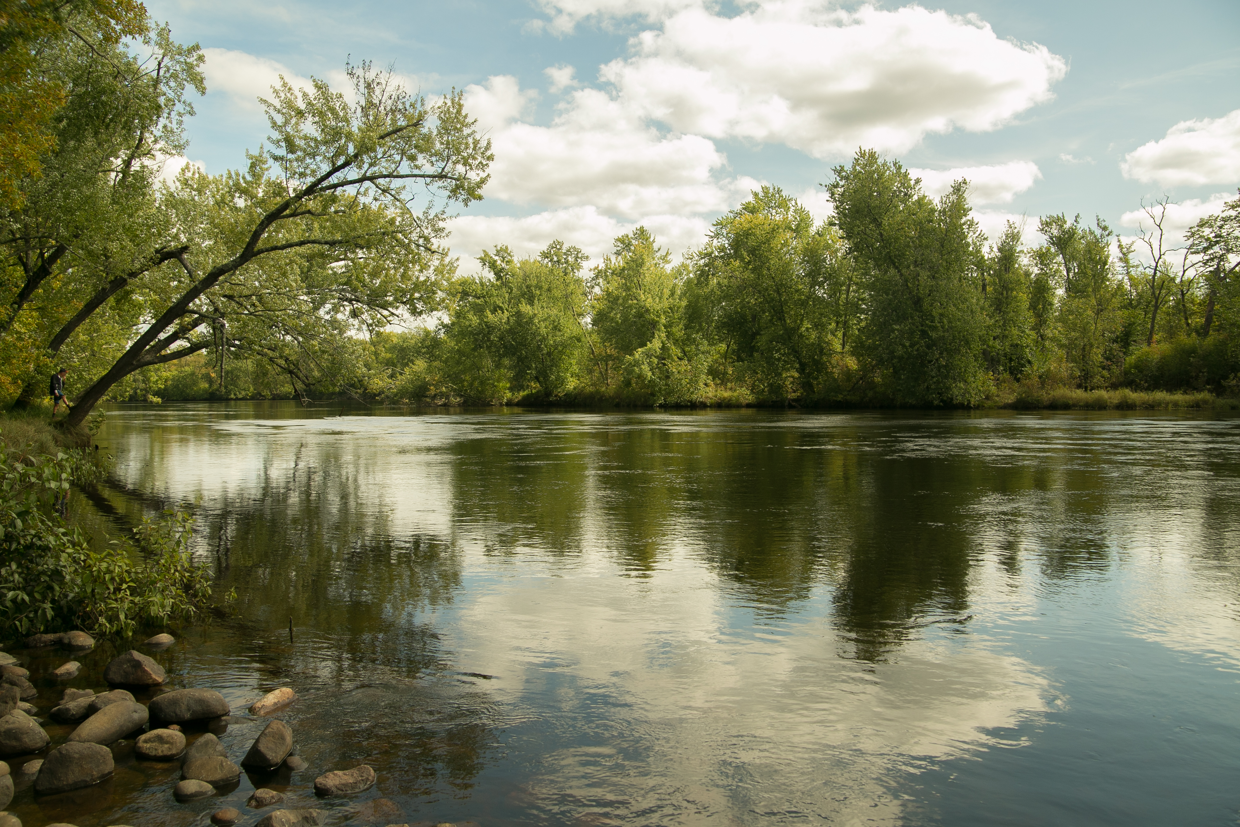
most people gravitate to gooseberry, but i would offer that jay cooke is the far superior (ha) park. just south of duluth, it’s where the st louis river is getting close to its final destination in lake superior. with the lack of shrubbery and grass due to slate, it’s a fascinating landscape (all up the north shore, really). the st. louis rolls its way around islands and over rocks, which seem to be the perfect location for a pine to take hold.

i can speak to the campground, as jay cooke was one of four parks i camped in over the summer. the spot was spacious – more than enough for two tents – and i was able to put my hammock up between two trees. the trail to the office and lodge was lined with tall pines, which smelled great, and the park had programming every night (the night lori and i were there, it was hoots and howls or something like that).

jay cooke is right outside carlton, which is a nice little town with a lot of historical significance once you dig in a little. the restaurant scene was surprisingly nice, and the drive on 210 to duluth from jay cooke was EXCELLENT.

4. william o’brien

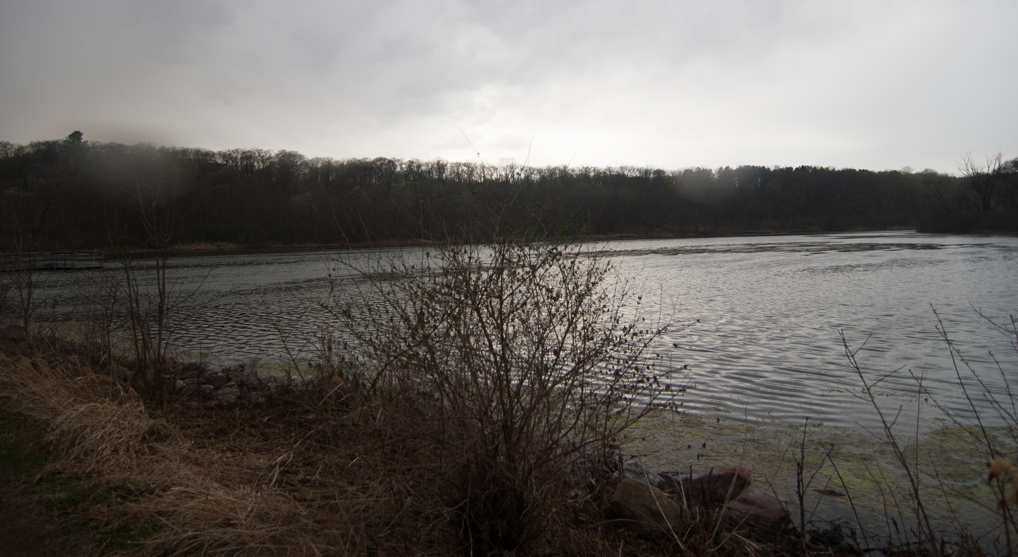
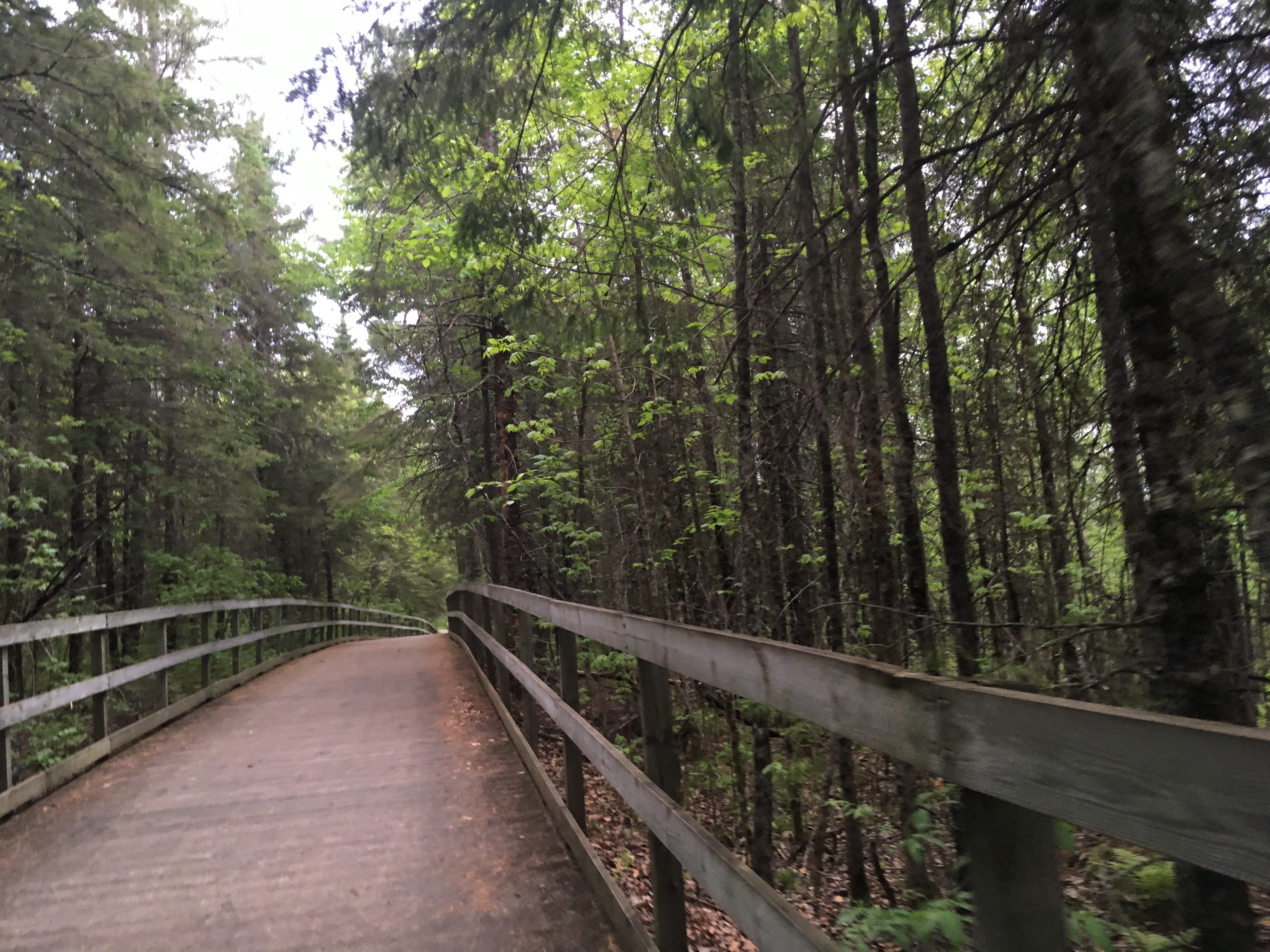
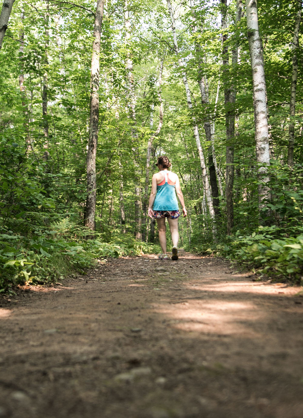
i have to admit – i visited william o’brien park in early may when the trees were barely starting to bud and the ice was JUST out. when i stopped at WOB, it was starting to rain and get gloomy. i wasn’t sure how i was going to like this park.

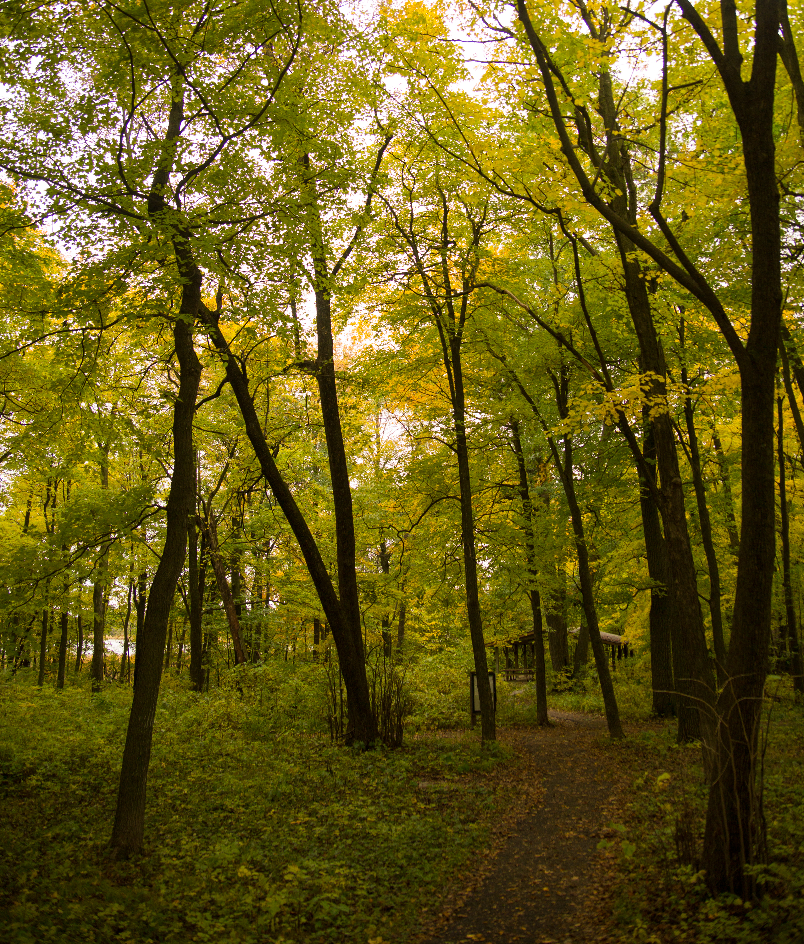
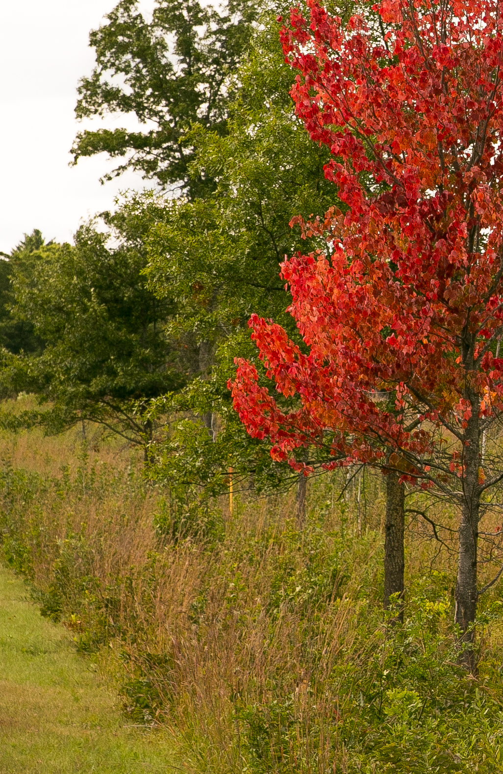
BUT, despite the gloom and rain and late spring, i would go back to WOB in a heartbeat. in fact, any of the parks on the st. croix river (see below), and just the drive along the st croix river, are worth the visit. WOB is in a very excellent location in the state, where the deciduous forest meets the coniferous forest, so you have pines and maples hanging out together in this picturesque location along a rumbling little river on its way to the mississippi.

here’s how i knew WOB is a winner: it was raining and i barely got out of the car so i could get the shot above, but even just a short car tour through the park and i was sold. in fact, i might head back there in the next couple weeks so i can experience the park again when it’s not so gloomy

5. interstate

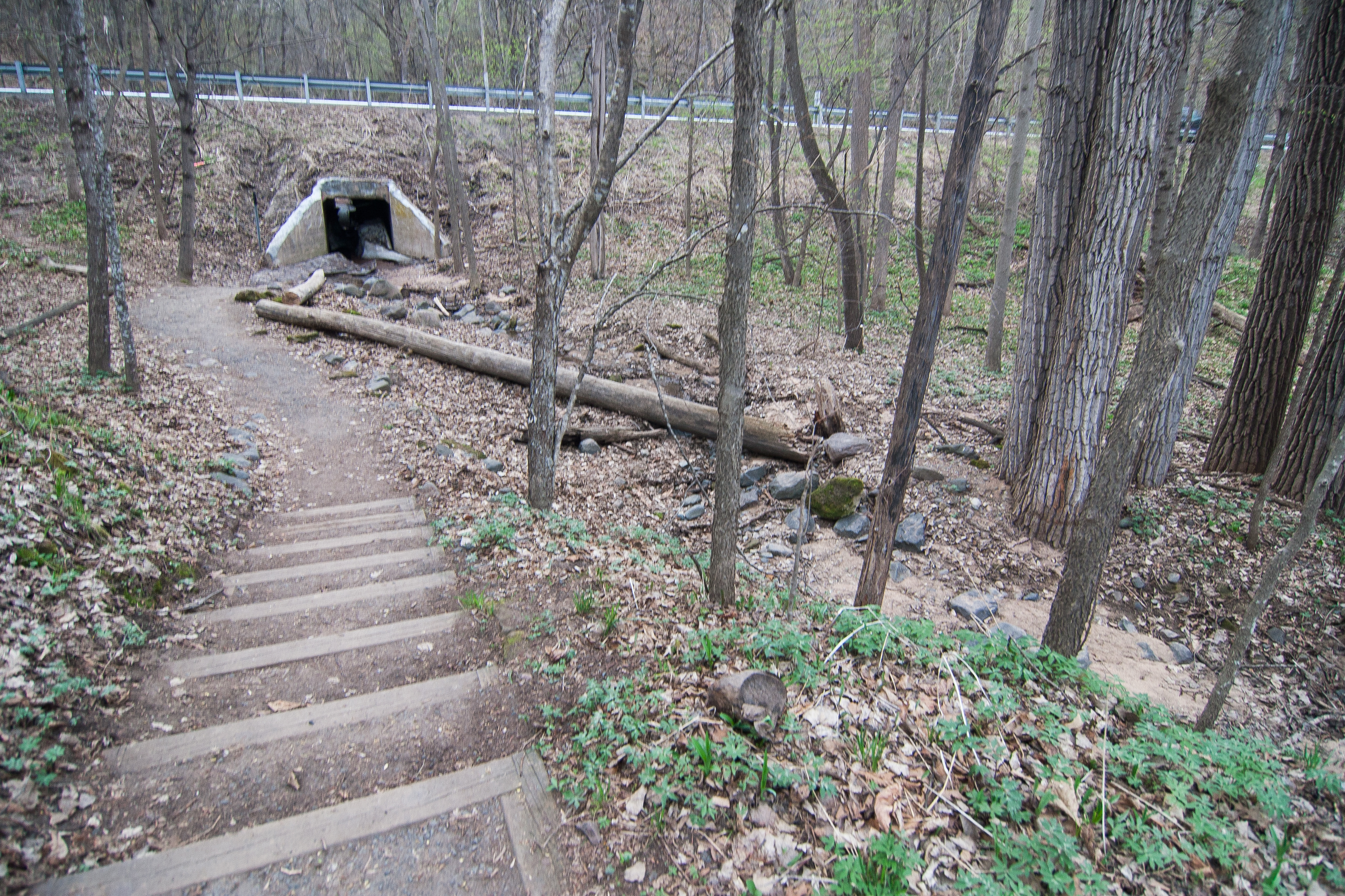
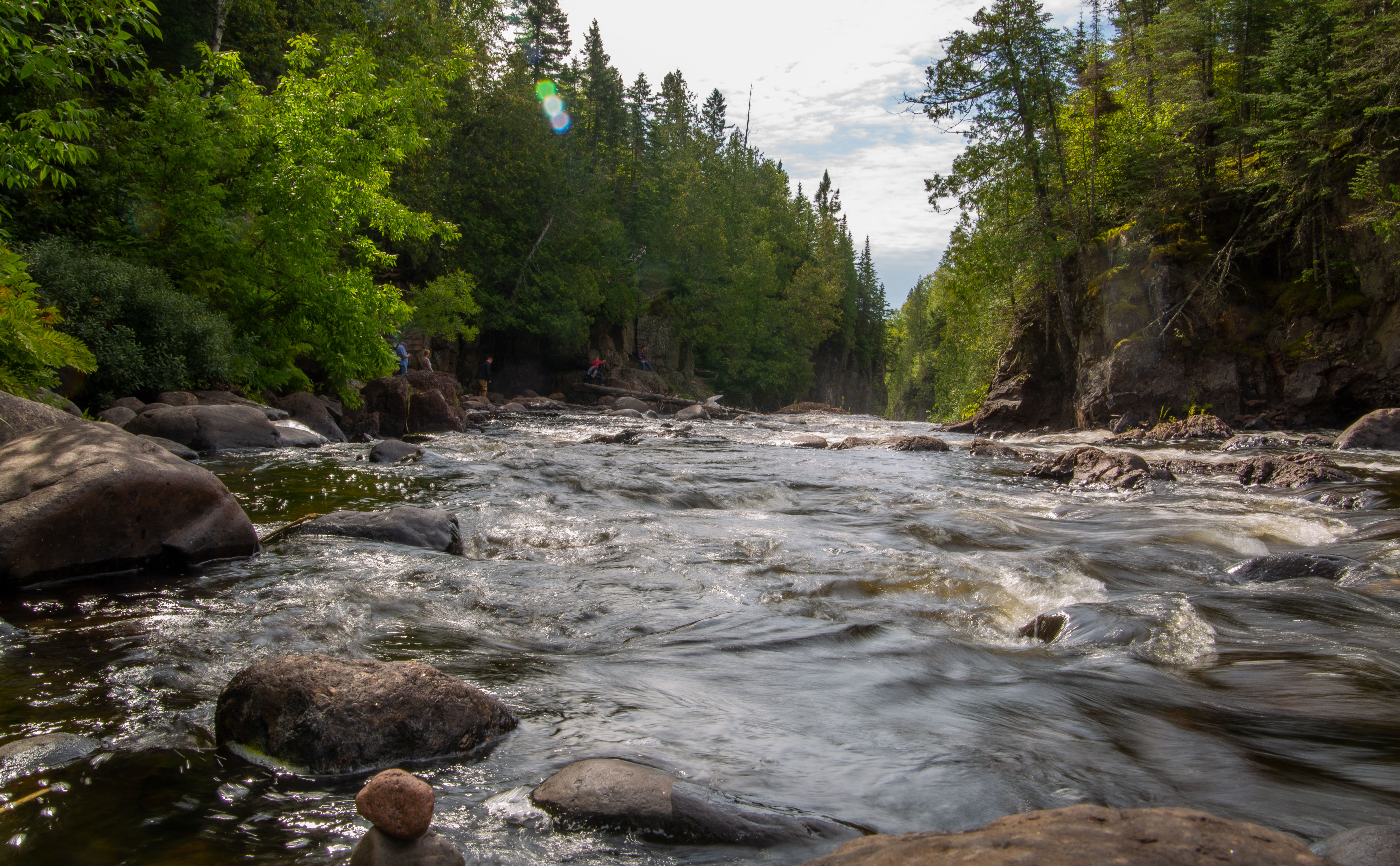
interstate is on my list for many of the same reasons that william o’brien is on my list, with one distinct point: the park is located directly on the st. croix river, giving you excellent locations for camping and listening to the water sliding past. the river valley and bluffs of the st croix are gorgeous, and although this park is small and bordered by busy hwy 95, it’s worth the visit and the stay.

i stopped at interstate the same day as WOB, so i know i’m missing out on  a lot of loveliness that this park has to offer. another thing i am doing next time i visit is stopping over to the wisconsin side (hence the name of the park), which offers the same sort of setting with much more park. the minnesota side makes up a small part of the interstate park.

interstate is also close to taylor’s falls, a quaint little historical village on the st croix.

6. frontenac

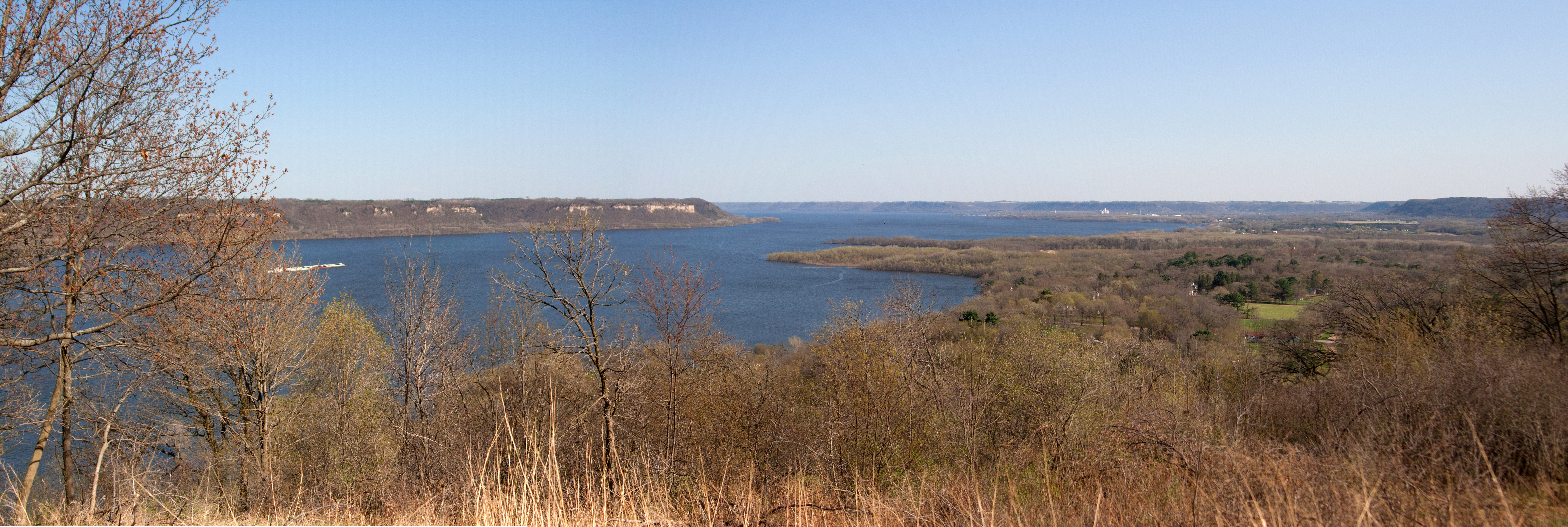
if you’ve ever taken the drive from the cities to winona or la crosse, you know the river road is one drive that you want to take at least once. frontenac seems like it’s a park that might seem a little boring at first: you drive through old frontenac, then up a slightly barren bluff to get to the top. but once you’re there? you’ve made it.

the chippewa river in wisconsin, one of the hardest working rivers in the country, dumps into the mississippi just northwest of wabasha, creating a delta that makes up lake pepin. yep, lake pepin is not the result of a man-made dam but a naturally made delta by a river that’s outputting so much water into the mighty mississippi that it creates a lake.

and frontenac state park gives you a giant view of the widening of the river, letting you take in the bluffs and barges and buoys. there is a series of wooden stairs that take you down to the riverfront, switchbacking their way down the bluff through the trees and foliage with the occasional deck overlooking the river with informational placards and benches.

while you’re there, make sure to take a quick tour through old frontenac, a very historical town with old plantation style houses that line the river to take in the view. the whole village is placed on the national register of historical places. i knew i was in for a treat when there was a horse paddock in the middle of town 🙂

7. zippel bay

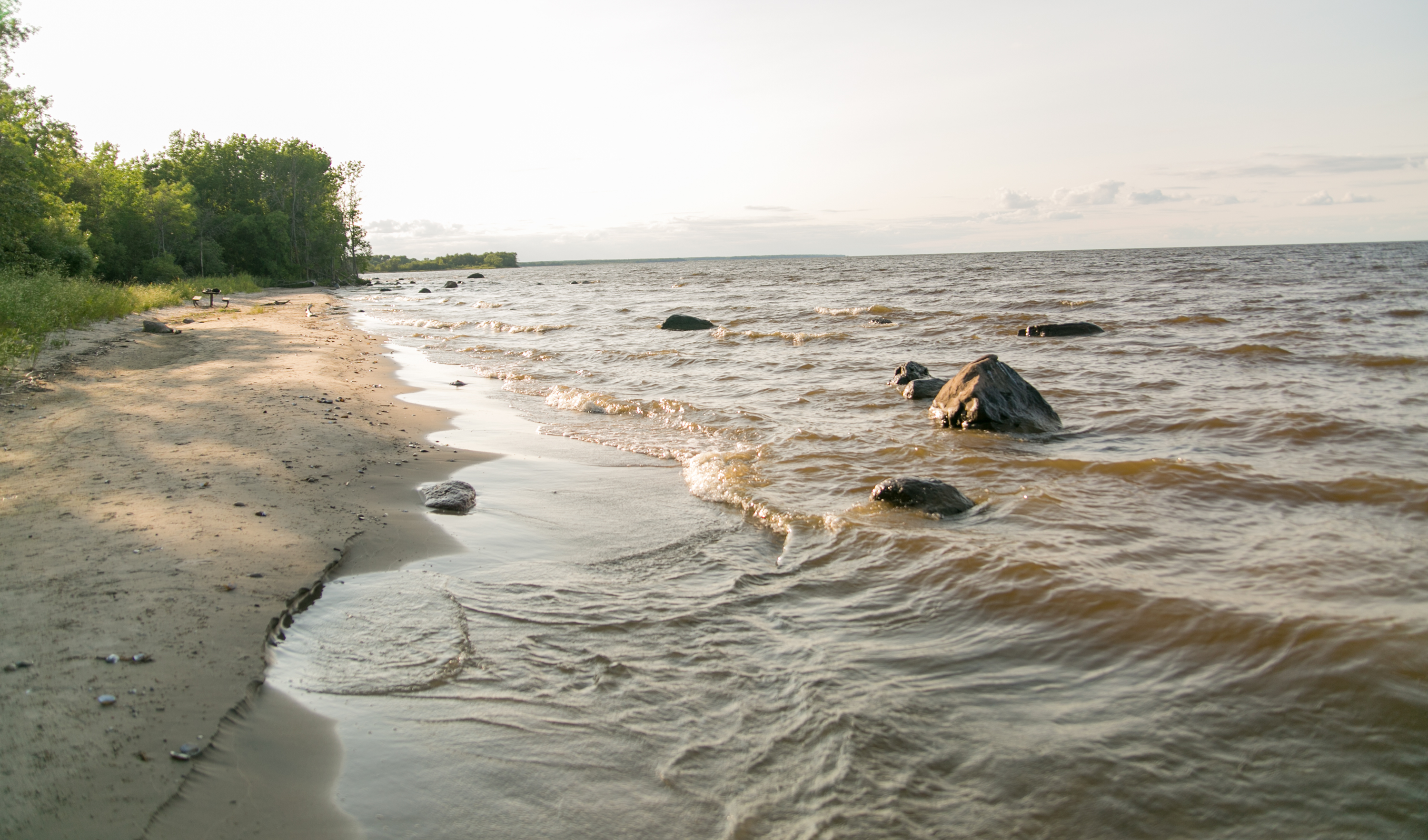
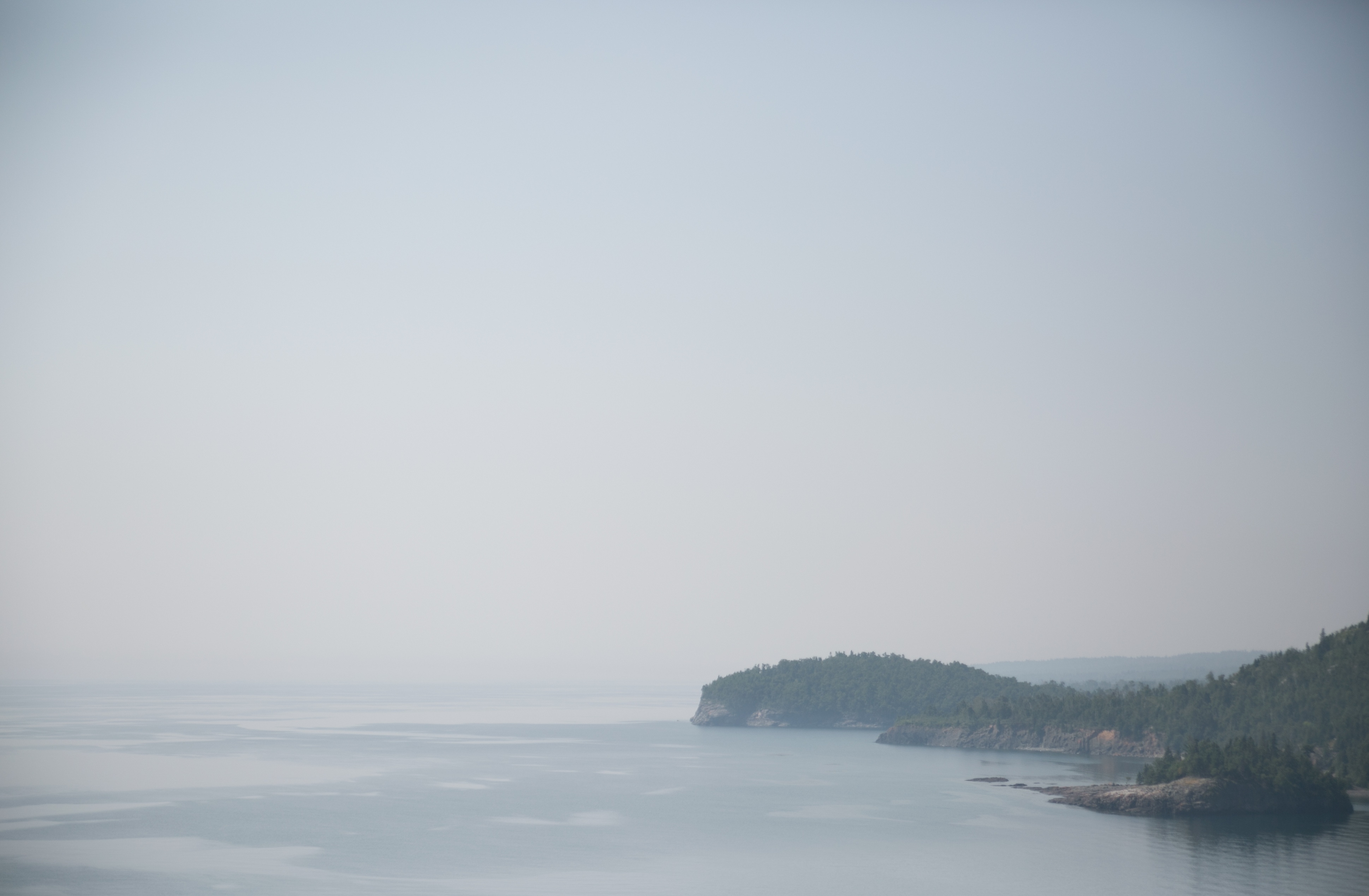
from the highly populated area of the metro and southern part of the state to the far north – zippel bay is the most northerly state park in minnesota, located on the southeast side of lake of the woods. (garden island recreation area is more north, but it’s located on an island in the middle of lake of the woods 30 miles from shore.)

white sand beaches and the shorter, less dense aspen of the area give this park an almost otherworldly feel. i stood on the edge of the lake and felt like i was on the edge of the world (well, edge of the country, that’s for sure). this lake has a different feel from the much larger lake superior, which is lined with tall pines and cliffs. and it was sparse – i was one of 3 people in the park and felt very much isolated, not only from people but from civilization. as i slept in my tent that night, i heard the waves crashing on the shore – a half a mile away.

it might seem like this park is almost too eery to recommend, but i highly recommend this park, if only to take the time to separate yourself from civilization. like i said, i heard the waves a half a mile away. it is never that silent in my neck of the woods. it’s rare that anyone experiences that kind of silence or darkness. the park is beautiful and awe-inspiring and eery and invigorating.

8. hayes lake

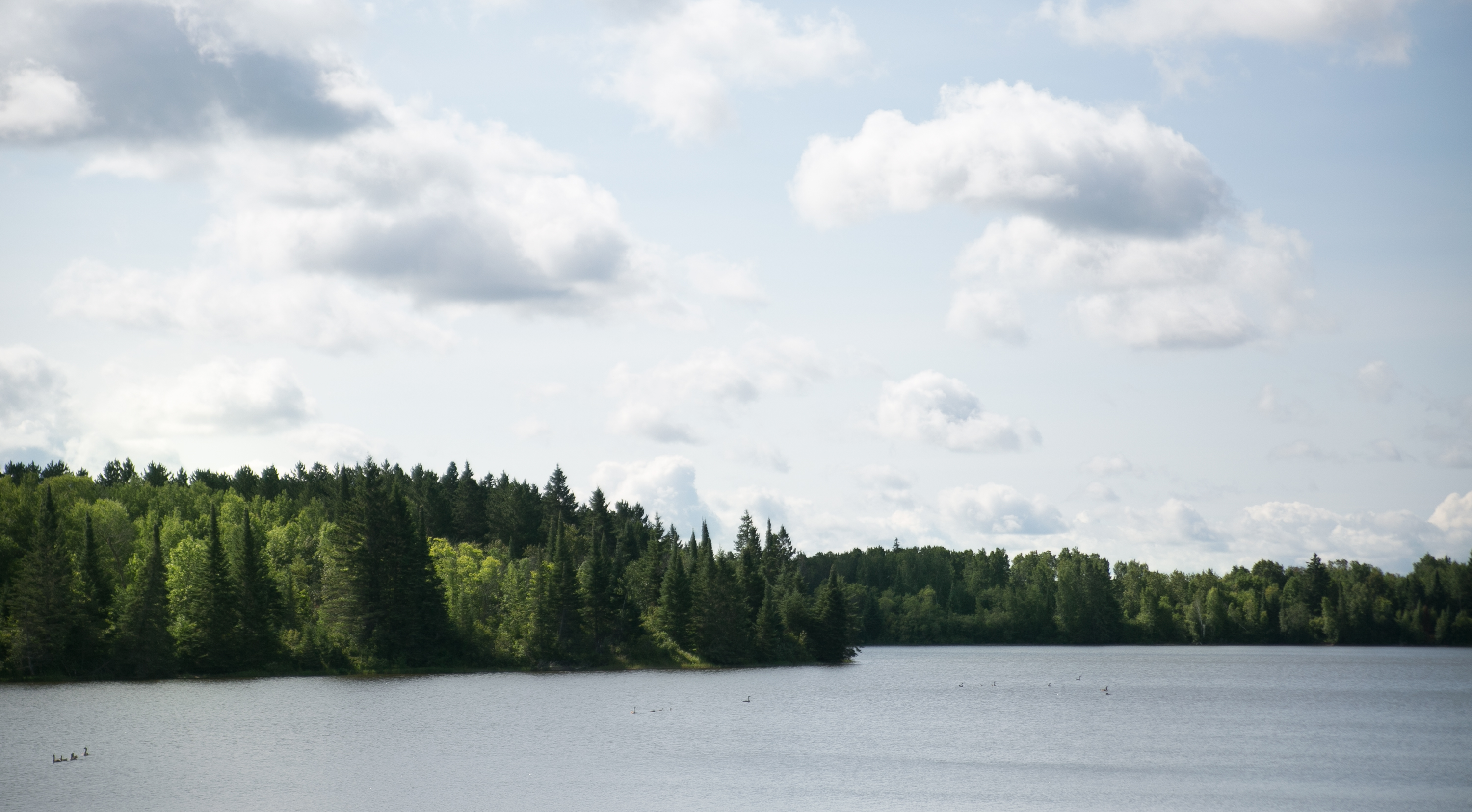
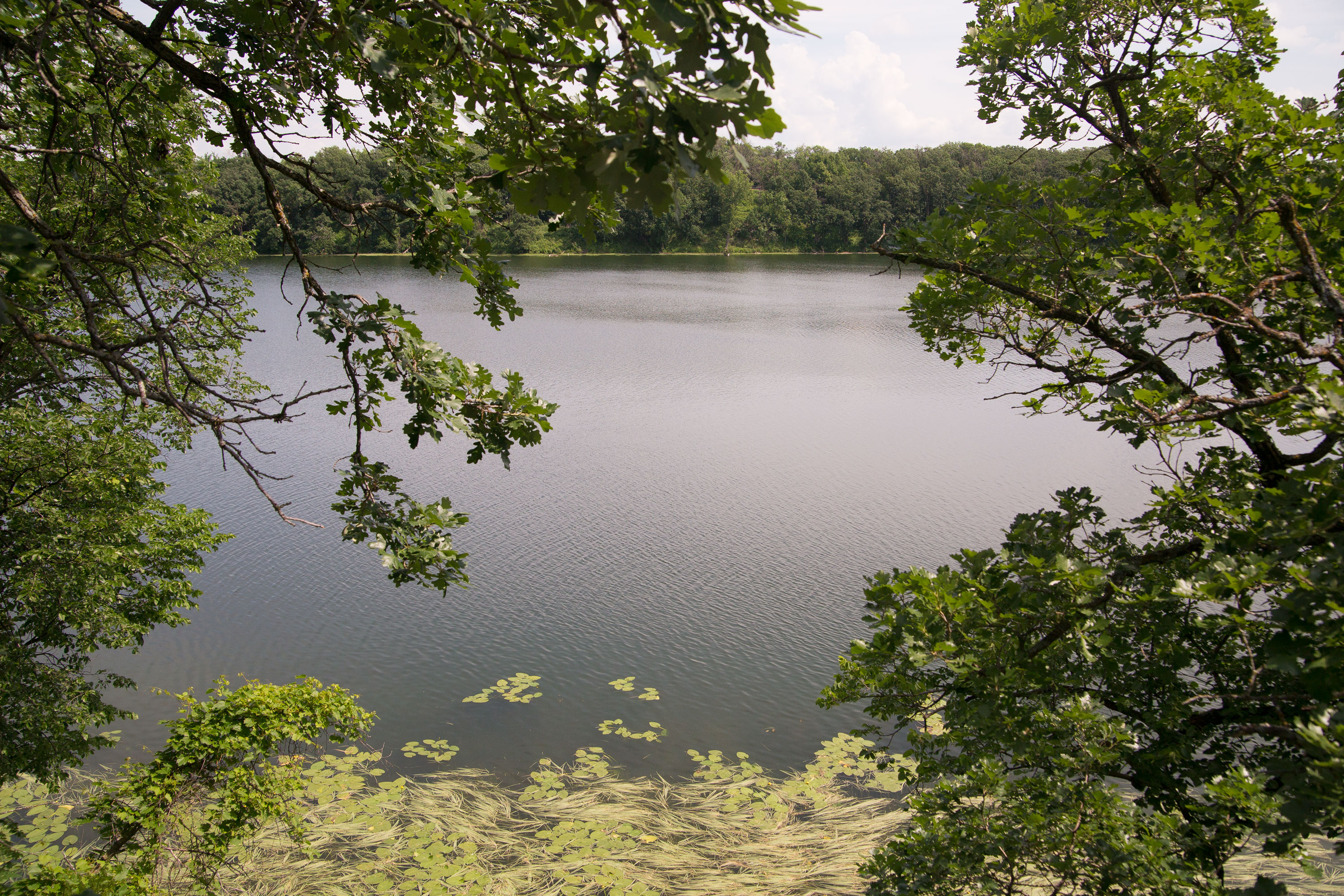
i almost didn’t include hayes lake in my top ten. in fact i’m still hesitant to add it, but it’s in a part of the state that people rarely visit and i think it’s important to expand our horizons.

also, it’s one example i’ve found of a man-made dam doing a lot of good for the environment. i’ve learned a lot about a lot of things while on my parks visits: the dakota resettlement saga; the oak savannah; the ecology, topography, and geology of minnesota; preservation and conservation efforts; and man-made efforts to contain rivers. in most cases, i’m pro-river, pro-environment. get rid of the control of the rivers and let water do its thing.

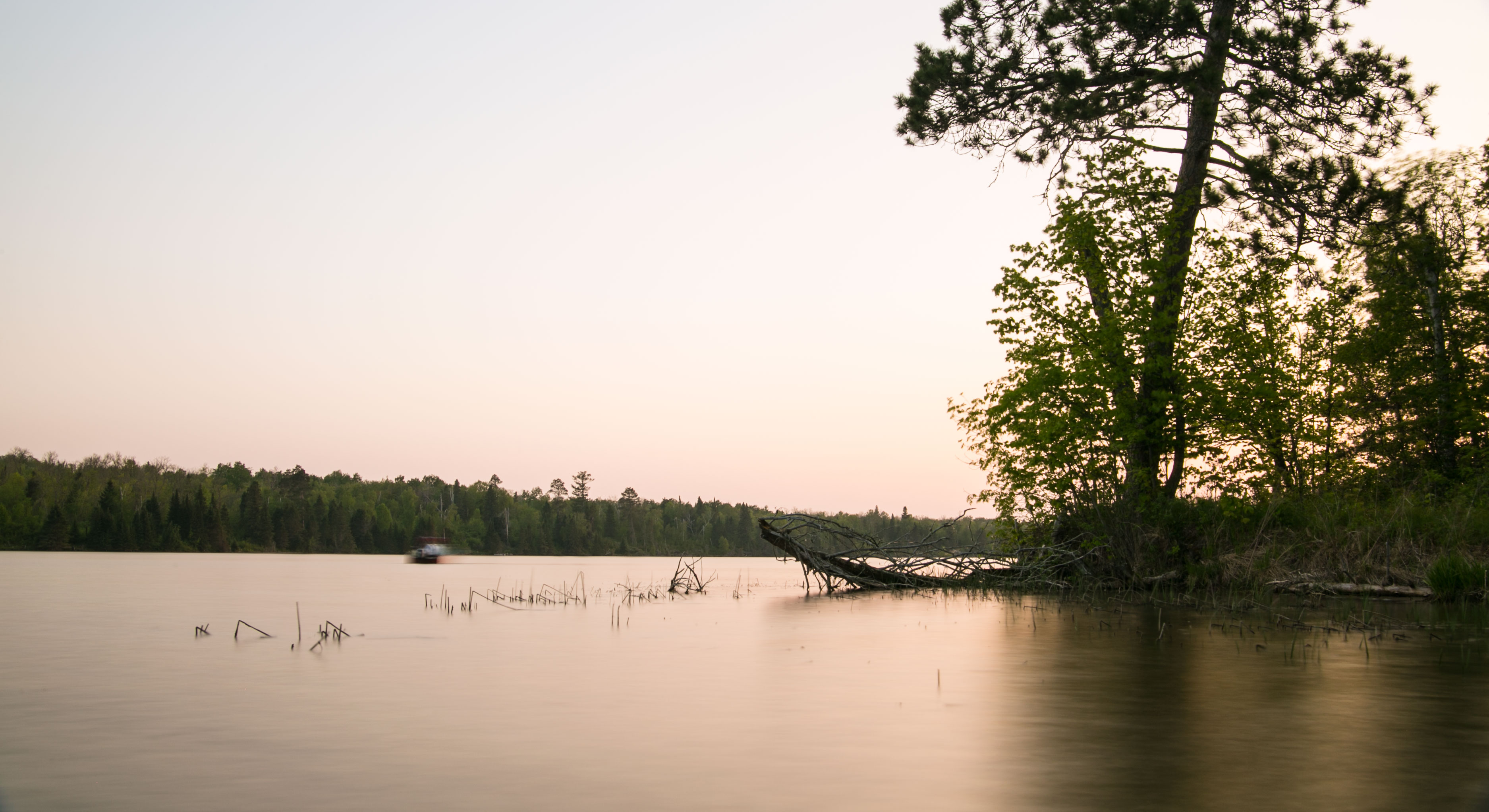
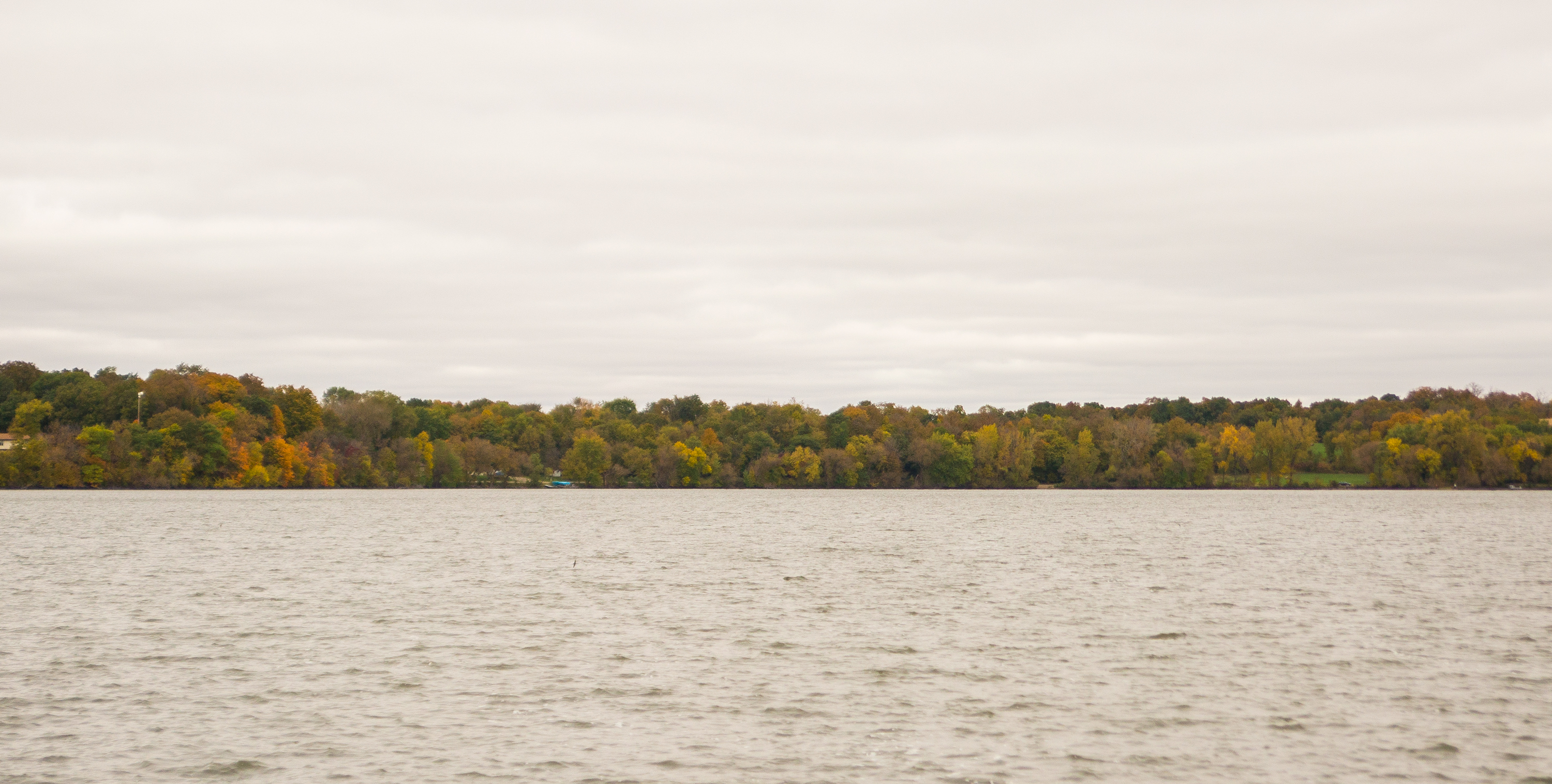
but hayes lake is in the middle of a lake droughted area that has a lot of wildlife passing through. so the addition of hayes lake in the early 1900s was a boon for the wildlife in the area, which you can see in the photo above. when i visited, there were a ton of fowl on the water, just paddling along.

the park is also quintessential north – the blue, crisp lake and green, tall pines.

9. whitewater

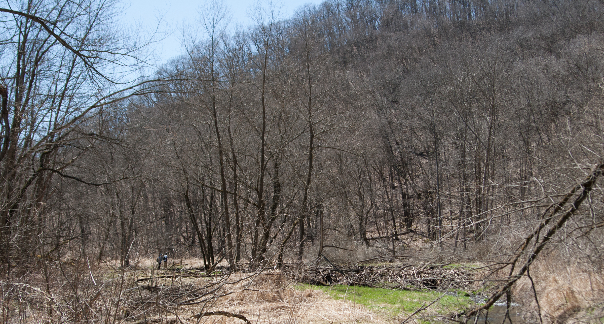
if i hadn’t lived 10 miles from whitewater for three years, i might not have placed it on this list. but since i knew more about whitewater than i would’ve with one visit, i would recommend a visit because of the park as well as the area of the state. the whitewater river flows through the park, creating the valley and large bluffs surrounding the park. there are several trails throughout, awesome trout fishing, and a fire tower if you feel adventurous. there’s a small “lake” in the park (i call it a pond where i come from), along with several picnic pavilions and picnic tables. it’s a great place to take a day trip. st. charles has a small bike shop for those who need to get a tune-up before heading out on the trails.

i’ll also give a shoutout to the bluff country of southeastern minnesota while i’m here: lanesboro, rushford, preston. the area is fantastic sight seeing, and if you’re a biking buff, check out the root river trail.

10. glacial lakes

number 10 was hard. i was wavering between sibley state park, banning, and glacial lakes, and in the end glacial lakes won out because of the varied area surrounding the parks. there’s a lake with cabins available to stay in and camping, as well as boating and swimming.

but i think the topography of the area is really interesting. it’s where the glaciers left gravel deposits as well divots, so there are hills and lakes throughout. it’s also technically in the prairie, and there is preserved prairie within the park with native grasses and flowers, but the area also boasts some hardwood forest, so you can see how the hardwood forests have encroached a bit on the prairie.*

BONUS: grand portage national monument (and judge cr magney)

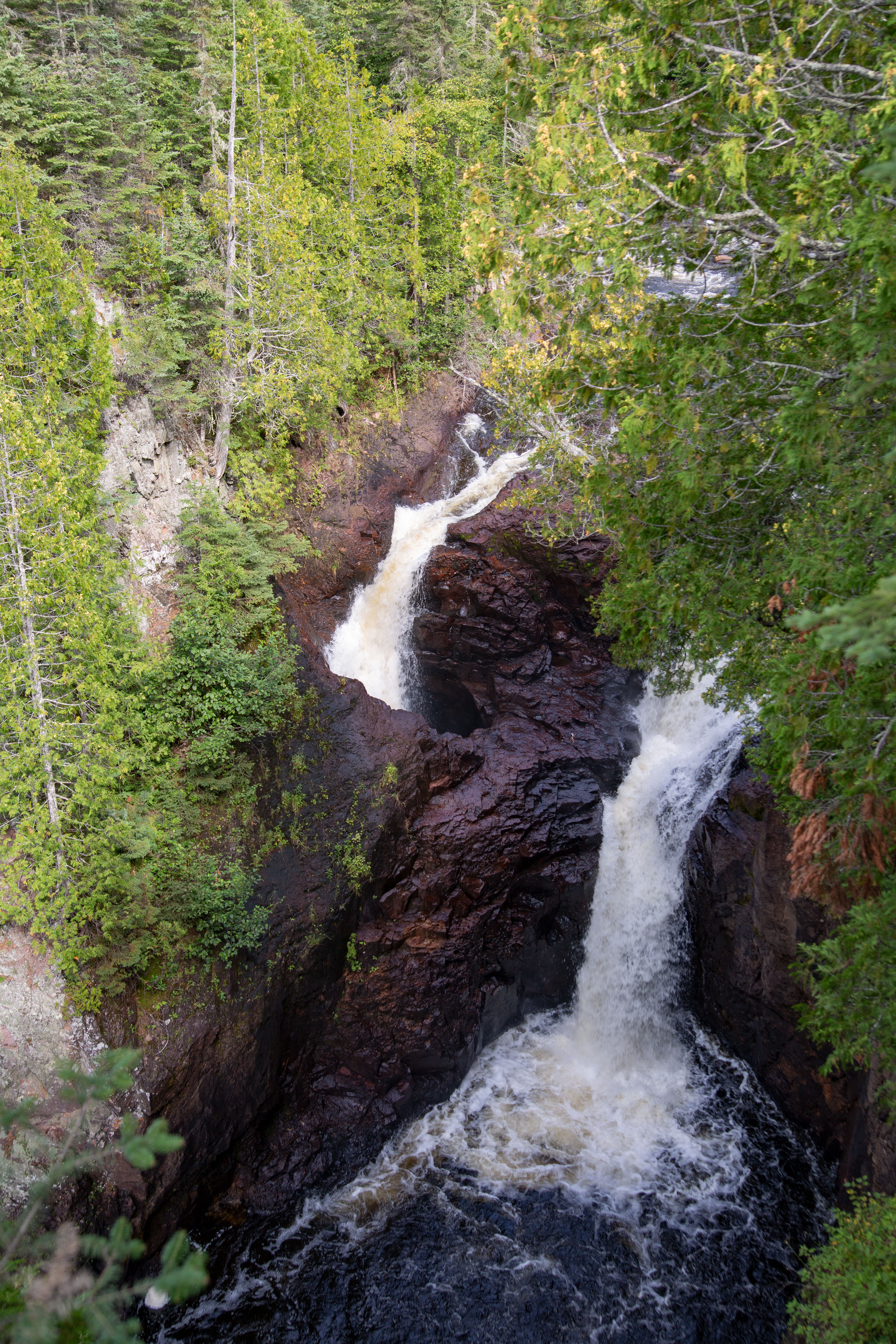
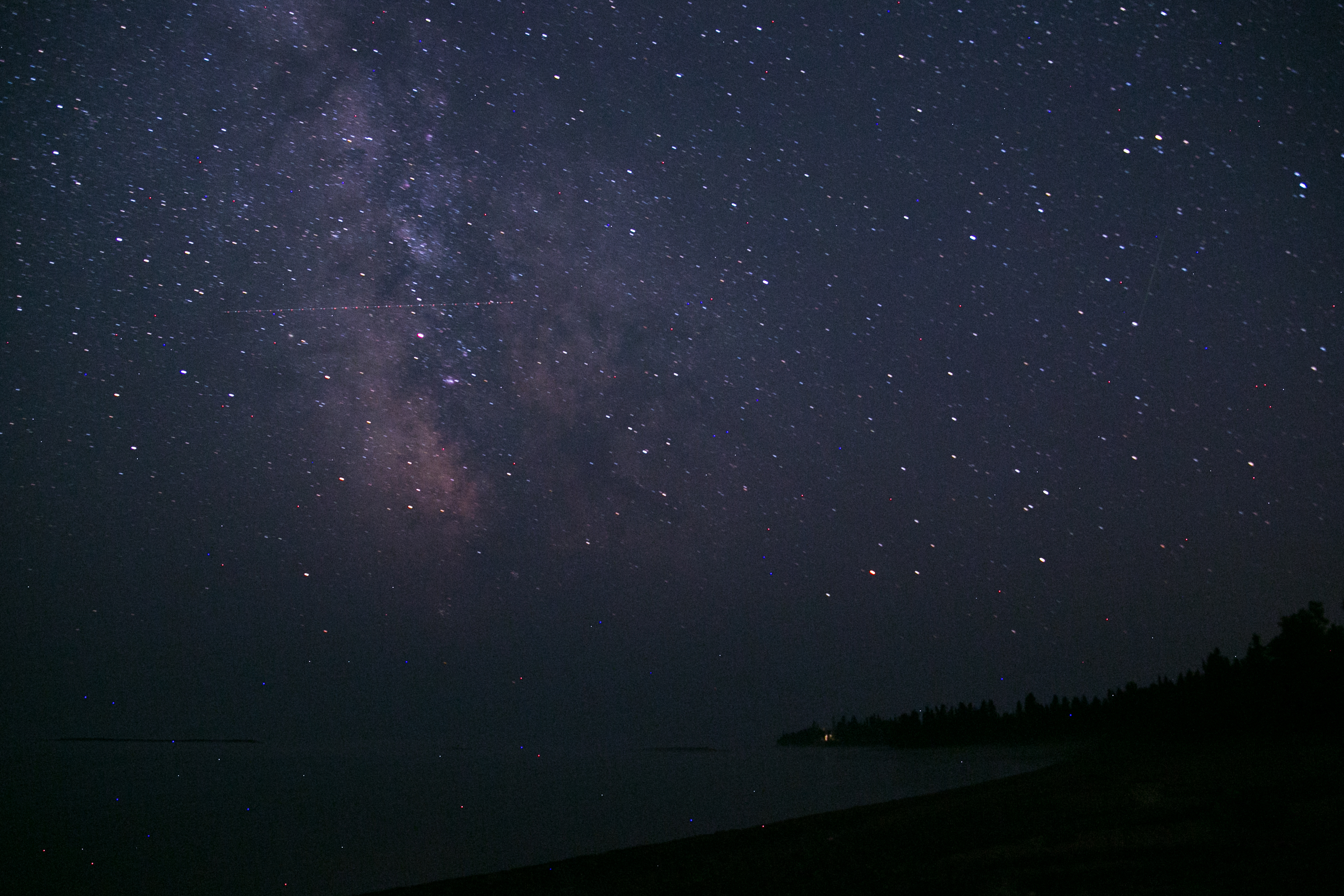
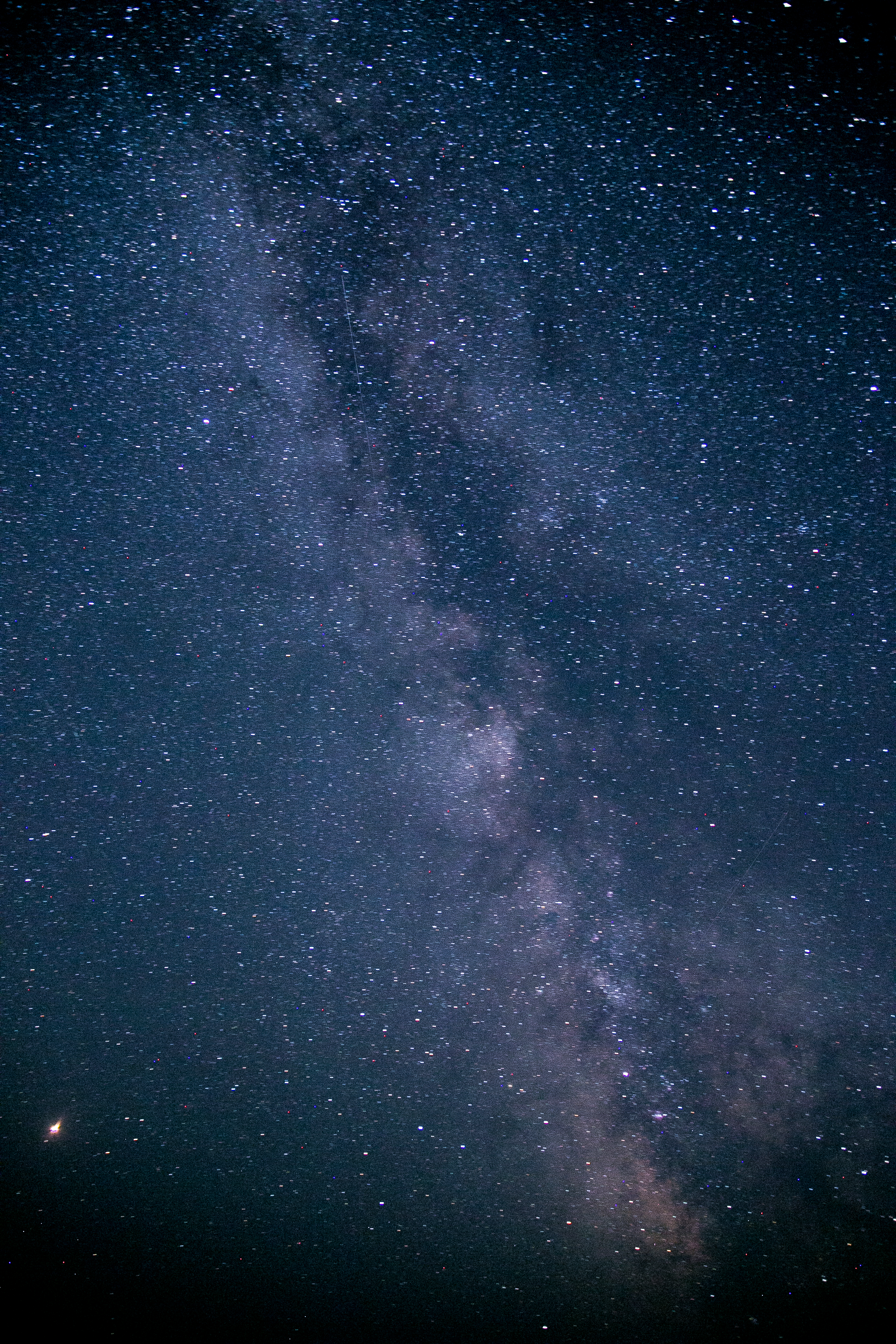
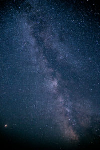
the farther north you get in minnesota, the more isolated you feel and fewer people you see. on the north shore jaunt, i stayed at judge cr magney park (home of devil’s kettle falls), where the light pollution is so small that you could see the milky way as soon as you stepped outdoors.

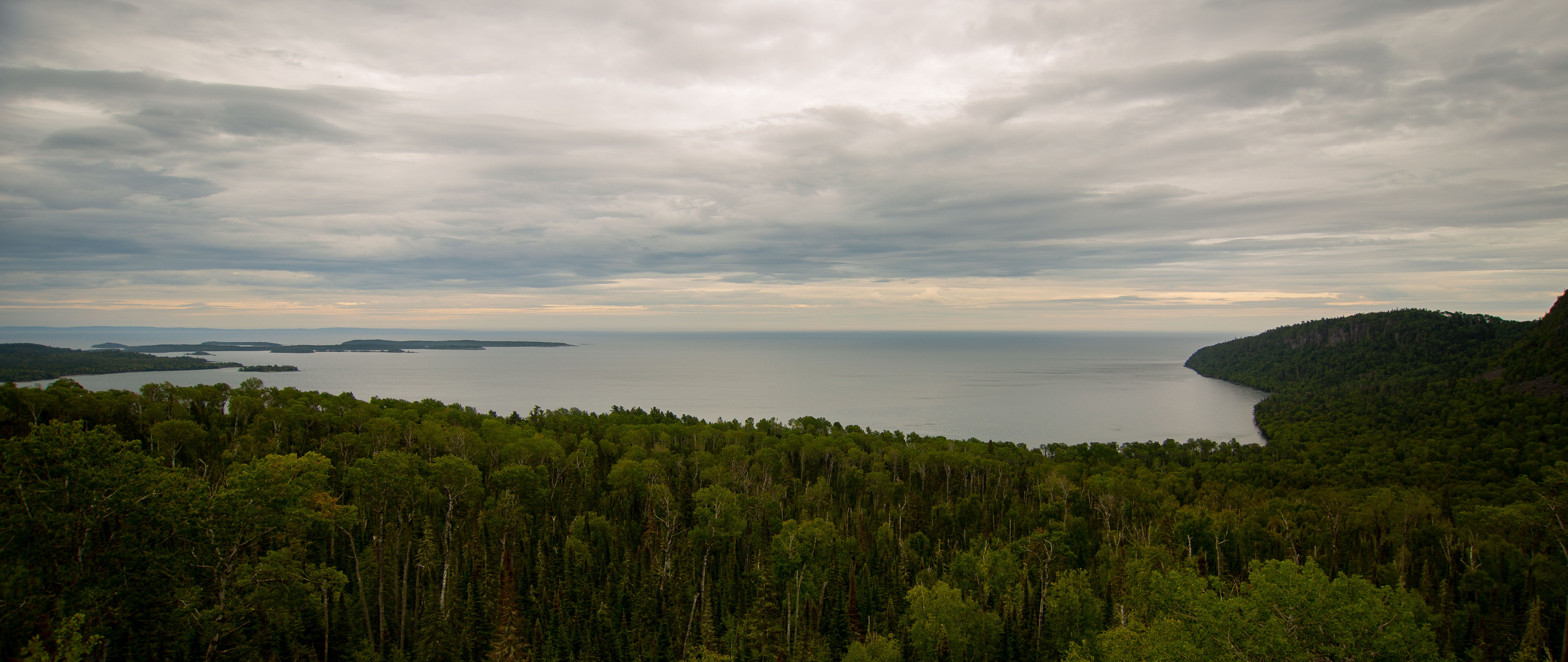
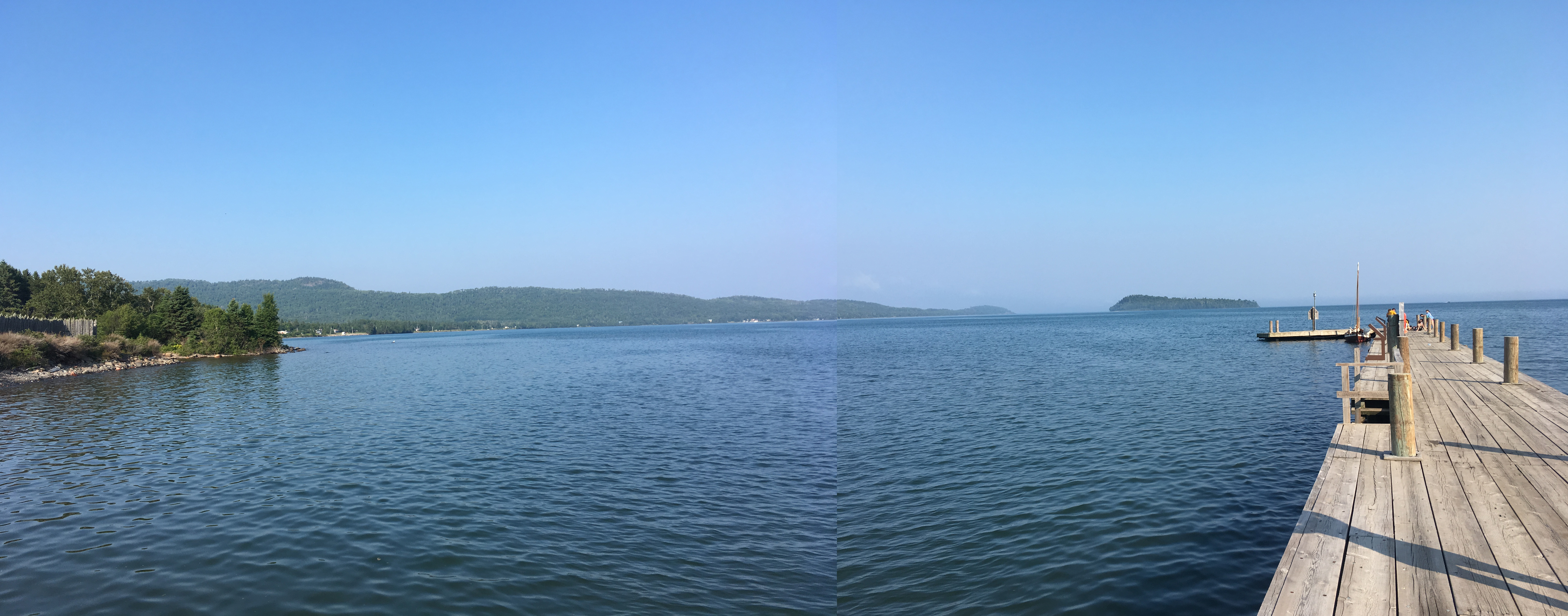
but keep going north to the tip of the arrowhead, past the majority of north shore visitors, and check out grand portage national monument.

the drive there turns out to be one of the most breathtaking in the state, with the road curving up large hills through the pines and the expanse of the lake to the east. at this point, the lake no longer crashes against tall slate rock outcropping but laps at shoreline.  as you pull into the national monument area with grand portage bay opening up below you, you can see why this was a popular place for furtraders and native americans coming and going in their large canoes.

unfortunately for lori and me, we got there too late for the visitor’s center, but we scoped out the historical displays and stood on the long dock. it’s not hard to imagine the haven this would have been.

********

every park i went to had something going for it. there was always something that was interesting, whether it was geological, topographical, the types of trees, water feature, etc. my top ten may not necessarily be anyone else’s top ten, especially since i confess to be a true trees and lakes kind of girl (and a person who appreciates south dakota).

what is great and what i encourage you to do is visit all the parks and find out for yourself what you like, whether it’s a refuge of a lake amid flat fields of corn (split rock creek state park, kilen woods), cascades (anything on the north shore), bluffs and river valleys (great river bluffs, beaver creek valley), or exploring the boglands (big bog – which is super interesting!).

and let’s take one paragraph to give some extreme props to the civilian conservation corps – the CCC. many, many of the parks i visited had some construction done by the CCC – whether it was the swinging bridge at jay cooke, the lodge and cabins at itasca, the water tower at lake bronson. your short history lesson: the CCC was a work relief program put in place 1933-1942 in efforts to get the economy going again (great depression, you know). it provided jobs to 3 million young men, who earned $30/month ($25 of which was sent home). the CCC planted 3 BILLION trees after conservationists pointed out that the loggers hadn’t planted any replacement trees. they construction trails, lodges, building, facilities in 800+ parks across the country. they created state parks, updated forest fighting methods, and did some public building and roadway construction. it was so popular that 82% of the public agreed with how it was working (can’t imagine that today!). so the style of the buildings you see in the state parks? that’s due to the CCC.

so. minnesota’s tourism office isn’t wrong one bit. explore minnesota. it’s really, really quite the mixture of greatness.

RUNNERS UP: here are the parks that i think you could also visit but are in the same area as other parks that i place higher on the list:

  • banning
  • anything on the north shore (hm… maybe cascade is the best one that’s not gooseberry)
  • beaver creek
  • st. croix
  • sibley
  • lake bemidji
  • maple river
  • BIG BOG
  • lac qui parle for the biggest cottonwood in the state
  • crow wing
  • great river bluffs

*you see a lot of oaks in this transition area. this is the oak savannah, and it used to be primarily oak trees and prairieland. oak bark is especially resilient to fire due to its thickness, so those trees stood after the other hardwoods succumbed to FLAME when prairie fires came through. after settlers started pouring in and putting out the prairie fires, the oak savannas disappeared and the hardwood forest started encroaching on the prairie. 

mn state parks: sakatah and rice lake

mn state parks: sakatah and rice lake

the moment came: saturday, i finished up my list of state parks to finish with sakatah and rice lake.

sakatah

i headed down I-35 and turned off at faribault to check out sakatah state park. the park is known mostly for its bike trails and the lake. it was a windy, dreary day, so i didn’t spend too much time at the park, just checked out the area where the lake access was: a picnic area and a solid restroom. the lake was choppy and the day was pretty dreary, like i said, so it’s hard to appreciate parks when the weather isn’t cooperating.

while i was stopped at the office to get my stamp, a couple walked in with a passport as well, with only 6 stamps in it. they asked how many i’d been to and were shocked when i said 71.

i was mildly shocked myself!

the guy who helped me out at sakatah gave me my second-to-last stamp and my certificate for a free night’s camping. there were a lot of people at the park, at least i thought so for the dreary day, which is a testament to how much the parks are used by locals.

(well, and not locals like me and the couple.)

rice lake

then it was off to rice lake, which is a more picturesque park than sakatah, i believe. the trees are a little more towering, and the new fishing pier is a nice addition to the lake to get people out past cattails.

this has a network of great hiking trails, and the picnic shelter you can sort of make out in the photo above. i think in another week, the leaves would be great at this park.

i rounded out my trip with a stop at the rice lake park office, where i chatted with the rangers about getting my plaque and how i managed to get 72 state parks and recreation areas visited over the summer. the form went out in the mail yesterday, and i should get a finisher’s plaque in 4-6 weeks.

i think she wanted to take my passport and mail it to them, but i insisted that i got to keep it (i read the instructions thoroughly). i would’ve felt naked if she’d’ve taken it away!

******

i’m kind of sad this is over! but i’m happy i did it so i know which parks to go back to. and it really put into perspective the different areas that minnesota itself has to offer.

THE END…?

THE END…?

i haven’t had a chance to get to my photos i took, but i just wanted to post briefly about the fact that yesterday, oct. 6, i finished up a 6-month endeavor to visit all the state parks in minnesota.

*applause for self*

i finished up by visiting sakatah lake state park, which is just west of faribault, and rice lake state park, just east of owatonna. and while i’m going to wait until i get my photos to do my reviews of the parks, here are a couple items of interest:

1. i filled out a form at rice lake, which they are going to send in to the state office, for a plaque that says i finished. exciting!

2. they were completely impressed by the fact that i visited all of them in 6 months. i find it surprising that there aren’t many people who finish in a short amount of time. they asked if i had summer off – i said no, i work 40 hours and only took maybe 4 days off total for this. maybe most of the people who do this are severely casual about the whole thing. not sure.

3. i’m going to edit my editorial to include some more information, and then i will send it to the startribune.

4. i will also do a top 5 parks post! i’m excited for that, because it’ll be interesting to see what i choose as number 4 and 5. maybe i’ll do a top 10.

5. we are scheduled for a trip to itasca next summer already! i am totally excited for it already.

that’s all i’ve got right now for parks. i’m happy i’m finished, and i’m happy that i know what parks i’ll visit again. and i’m really happy that i accomplished this goal!


closing in

closing in

this weekend i went to wisconsin to check out locations for a cabin* shared with my sisters and to visit jenee. on the way back, i dropped in to st. croix state park.

when i started in april, there was snow on the ground, and on the drive through st. croix, the leaves were changing and starting to shove autumn right on in. i got stamp # 70  in my passport, another display that time has just slipped right on by this summer.

i have stopped at st. croix before on the way past.  there’s a section of the park that sustained some pretty severe wind damage in 2008. the last time i was there, i drove past and kind of poo-pooed the landscape because it wasn’t very appealing. but NOW i know: what’s really super interesting is that the wind damage started an unintentional restoration of a pine-barren oak savanna habitat, which is really rare in MN and other areas. wildlife and birds now have habitat opportunities that they haven’t seen since settlers came in and started plowing and restricting the wildfires that maintained the oak savanna. the oaks are kind of scrubby and there aren’t a lot of big, old-growth oaks, but they are here and there across a wide expanse that have no other trees. red-headed woodpeckers have reemerged in the state with this new old habitat.

the st. croix is a lovely part of the state, from stillwater up to duluth, all the state parks i’ve visited on the st croix have been especially nice.

just two parks left, which i will pick up in early october.

before then, you’ll hear from me on RAGNAR and also i’m heading to the black hills the first week of october (YAY).

*we decided on the minong area! now to save up enough for that down payment.

mn state parks: mn river valley

mn state parks: mn river valley

after a lazy-ish labor day weekend, i decided to get on the road and pick up a state park that was relatively close but i hadn’t gotten yet: minnesota river valley state recreation area.

this park is located to the southwest of the cities, between jordan and belle plaine. i headed out a little before noon and took the backroads down.

the MRV is on the minnesota river bottoms, so it’s very flat and very sediment right. it’s apparently also a great place for horseback riding.

i took a quick hike along the bottoms after i got my stamp just to see what it was all about. i was reading on the dnr site that often this park is flooded and only a few trails are open. you can see the evidence of the flooding all over the place! but the tall trees and the sparse ground was a perfect place to imagine imps and will-o-wisps and tree faeries frolicking about.

there was also a lot of evidence of horses! this is a good place for horse girls to come get their fix. i will also add that for a recreation area on a weirdly humid, chilly day, there were a lot of people around. i guess location is helpful, too, it being relatively close to the cities. on a sad note, it looks like they used to have a campground, but no longer. the campground part of the sign was painted over. i’m not sure if this is due to the flooding or lack of funds for the dnr.

after my short hike, i headed home by way of visiting jane. my labor day weekend didn’t seem quite so pathetic anymore! and i am one stamp closer to the end of my stamp book: just three parks left.

next weekend i’ll stop at st. croix on the way to wisconsin.